Tuesday, August 23, 2005

Nudestock is this Saturday!

Nudestock
Starts: Saturday, Aug 27th, 2005
Hours: 11:00 AM - 5:00 PM


Nudestock is a day of music at Fraternity Snoqualmie Family Nudist Park on Tiger Mountain in Issaquah,WA. The beautiful green sunning lawn makes a natural ampetheatre for this years line-up: Sister Monk Harem, Mary McPage Band, and Late Night Trash. Members and guests of all ages will enjoy music, food, massage, and craft vendors while relaxing in the 2 hottubs, swimming and wading pools, and playing sand volleyball.

Additional notes:

Nudestock is a regular day at the park with music. This means that if you are a prospective member, your first visit is free. A one day membership is $17/person, $22/couple. After your third visit you need to join FS, or an affiliated nudist organization such as the American Association for Nude Recreation, or The Naturist Society, or be the guest of a member. Bring sunscreen, a towel to sit on, and photo ID to check in. For more info call 425-392-NUDE RV

Directions to Park Forestia/Fraternity Snoqualmie

Travel east on I-90 to the second Issaquah exit. Bare right onto Front Street. Follow Front Street south for 3.6 miles. That road will turn into Issaquah-Hobart Rd. SE. Things to look for along the way. Seattle Paragliding club & landing zone. Hayes Nursery. These will all be on your left. About a block past Hayes Nursery, there is a gravel road and a big green pole with the FS logo at the corner. I believe this is SE 127th. Follow this road up the hill to the gate and ring for the gate attendant.

Friday, August 19, 2005

Scenic Creek and Huckleberry Picking (au' natural)

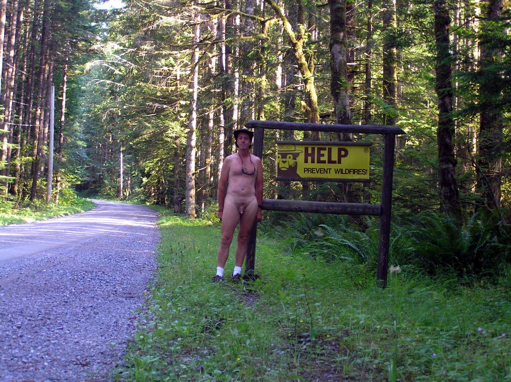
My hike didn't start as a 'huckleberry hunt" . . . just a couple of free hours and a need to get out of my clothes and enjoy the great weather. And one of my favorite short hikes is to the water falls and cascades of Scenic Creek as it approaches the Tye River Valley and Highway 2 east of Stevens Pass. This turned out to be two hikes in one . . . satifying my appreciation of the raw majesty of the Lower Falls and then, completely out of character to me, driving the couple of miles up Highway 2 without bothering to pull at least a pair of shorts on, to hike up to the Upper Falls area.

I'd always wanted to hike further up the course of Scenic Creek to see if it were possible to approach the sources of the creek up in the mountains. Although I didn't accomplish that goal this trip, I did discover numerous mountain huckleberry shrubs bearing ripe fruit as I climbed higher.


The Lower Scenic Creek Falls


The lower falls are easier to access . . . in fact, ridiculously easy to approach, which surprises me as I’ve only seen one reference ever to these falls and those directions would have led you astray. The easiest approach is just back from the Surprise Creek Trailhead. There is a small bridge that crosses the combined Scenic and Surprise Creeks, then further back an small gravel access road that serves as BPA access. Fifty feet or so further back on the road, but before you reach the small wooden sign advising the need for Forest Services Passes, you can see a meadow-like area where Scenic Creek passes by 20 yards or so to the east. This is your access point.

The Lower Scenic Falls with a great, shallow soaking pool at the base


The falls are simply reached by following the creek for a quarter of a mile, skirting the slopes and avoiding the low spots where Devil’s Club proliferates. There is a small trail but it is hard to make out because of disuse and overgrowth.

The Upper Scenic Creek Falls

To approach the upper falls area you can either attempt the perilous southern slopes around the lower falls and thence across the very steep BPA clear-cut area, or you can approach them easier from the east via FS Road 850 . . . the traditional access to Scenic Hot Springs.

Forest Service Road 850 is gated 300 ft from the entrance on Highway 2, so park carefully on the side (do not block the gate and display your Forest Service Pass). There may be other vehicles parked here . . . those are the people sneaking up to Scenic Hot Springs, which, although officially closed, still attract a hard-core segment of soakers. You share the hike up the forest service road as hot spring travelers until the BPA clear cut area. There, they head to the left and up along the road while you head right along the access road on more level ground. Just before you come to the next BPA tower you will see a rather large granite boulder on the side of the road. You can’t miss it . . . it’s twenty feet long and ten high. Looking into the tree-line just across you will see the evidence of a trail leading into the forest. This is the easy access to the upper springs area which avoids the steep scramble over boulders, skree, fallen trees and impassable Devil’s Club.

The water is cold but oh so refreshing pn a hot summer day!

This is a great area to hang out naked. Few people ever come up this way because of the difficulty (unless you know the secret trail). In truth, I often hike nude straight from the gate on FS 850. You may meet a few hot spring travelers on occasion but they are se’la’vie on the matter. You may want to clothe up for the short trek into the trail because of brambles and dry tree branches. Like I say, this trail is not well known and therefore un-maintained. Once you reach the meadows area of the creek, itself, you are in open forest with plenty of room to move about. There are great areas for camping and even remnants of old campfire rings above the view of the ramparts of the upper falls.

One of the many, many cascades of water in the upper courses of Scenic Creek

This area is superlative in itself and I could spend an entire day just lolling about the easy, moss-covered meadows or exploring the numerous falls, themselves. However, this hike is about searching for that elusive “Huckleberry”. Pickings are rather slim at this elevation . . . the Mountain Huckleberry likes it a few hundred feet higher so off I went, headed up alongside the creek’s steep cut into the granite of the mountain. The hiking is easy with plenty of opportunities for picture-taking (if you like mountain streams, that is). The forest is open and the major impediment, the numerous fallen trees, easy to climb over. Mountain Blueberry abounds . . . small, and sweet dusty-blue berries. About a hundred or so feet uphill you pick up an old trail worn into the overburden that generally follows the east-side of Scenic Creek up.

Now is the time to apply the bug-repellant, if you haven’t already done so. With all the fallen wood rotting into the humus, and the warm, moist days, those midges and biting gnats are out in force. No deer or black flies, fortunately, but the gnats are a real irritant. Use bug-spray!

Blueberries are sparse down below but the higher you get the more the bushes seem to contain. Others have been in the lower area to harvest them, it seems, but few wander this far up and the trail is very often very hard to make out. Then I spot my first Huckleberry!

The shiny, black fruit of the mountain huckleberry


Blueberries and Huckleberries may seem similar but are from different taxnoma. Blueberries are smallish, dusty-blue and tend to cluster on the bush; whereas Huckleberries grow a single berry from the axial of the stem. There are many varieties; we are in search of the Mountain Huckleberry, which is indigenous to these slopes at the higher elevations. Huckleberry doesn’t like the very moist areas, which is fortunate because I don’t like Devil’s Club. They grow higher and away from streams, seeking out areas where they can catch shady sun.

Mountain Huckleberries are slightly larger than wild blueberries, with a shiny black skin. Unlike blueberries with their skin-staining purple flesh, Huckleberries have a clear to translucent flesh, course seeds and a somewhat musky taste. Pick the individual berries between finger and thumb with a rolling motion out at the base. A ripe berry comes away easily and without squashing.

Bears like Huckleberries as well and it’s best to be awarethat these forested slopes and streams are bear country. Make sure that you make plenty of noise so as to alert and discourage any nearby foraging bears. Bears don’t like contact with humans any more than we want to meet a bear in a surprise encounter.

The trail just seems to disappear a couple of miles up, making me unsure of the approach to Lake Hamada, the source for Scenic Creek. I’ve got my plastic bag full of berries and a couple of hours of enjoyable solitude . . . au’ natural. A good afternoon.


Credit to unknown photographer . . . I've met bears but never this close

This is not what you want to mess with . . . a mother and her cub. It is best to steer a wide path around and make sure she knows where you are.


Sunday, August 14, 2005

Busy Week for Me

The clothing-optional area of Rooster Rock State Park looking east up the Columbia River Gorge. Sand Island is to the upper right of this Google Earth image

I got a few nude hikes in under my belt . . . which I will post about when I get the chance. Kinda busy these last few days with other issues . . . including "work". On top of that, the blower motor went out in my Honda which means I ain't got no air conditioning. Spent a good part of the day Saturday taking my dash apart only to discover them Honda engineers designed it so that you have to dismantle the air conditioner evaporator in order to get at the blower motor . . . and, of course, that takes specialized and certified shop work to do. Ah, well . . .

Wreck Beach Bare Buns is coming up this next weekend and I'm still not sure if I'm going to make it or not. I'd like to. The other option is to make another run down to Sauvies. Or possibly both, Sauvies Saturday, Wreck Beach on Sunday. I need to get out and keep my tan up!

I met with Mr. Sato, the owner of Scenic Hot Springs earlier. The good news is that the county has accepted the 'forest park' concept of his plan as opposed to trying to define it as a 'destination'. Takes a lot of the hassle out of some requirements like public meetings, county approval, etc. The big picture has been accepted. Now we have to work on the details. Wish I were as optimistic as the owner.

The other project I got started on came about because of a tiny little problem I feel could affect the future of Rooster Rock's clothing-optional area . . . and potentially Sauvies. I mentioned in a previous post that people had been boating to the northeast side of Sand Island and giving the nudists in the area a difficult time.

At the time I thought it was an anomaly but I have read of several other occurrences since . . . one requiring the park rangers to intervene. Sand Island is completely within the clothing optional area but it was pointed out to me that until the river goes down far enough, the only way to get to Sand Island is by way of boat . . . and there are no signs informing boater-landers of the clothing-optional status of the island. It would be very difficult to keep clothing optional signs on that shifting shoreline given the rise and fall of the Columbia.

Granted, those boaters may not even be aware the island is part of the clothing-optional area and therein lies the potential for trouble. Conflicts between textiles and nudists will make the area uncomfortable and if naturists stop going to Rooster Rock, we have a return to the past days of inappropriate use of the area by 'bushwackers' and sexual activities that TNS, AANR and the Oregon State Park Department tried to reverse in 2003 . . . and that, since, ORCOBA has tried to clean up as the local advocacy group under TNS/NAC.

A good portion of the area has been GPS'd with the idea of clearly delineating the clothing optional area . . . for promotion through appropriate sources (the ORCOBA website, handouts, possibly to boat dealers and suppliers). The idea is to inform the public of the clothing optional nature of the area and minimize conflicts. I believe it is absolutely essential for naturists and nudists to get down to the beach and show that it is being used and that we will not condone illicit sexual activity in the bushes and we will not allow parts of our beach to become de'facto 'textile' because of disuse.

This 'enhanced' image shows the recognized trails in the clothing-optional area of Rooster Rock State Park. Credit goes to ArrRoger d' Jolie of ORCOBA for walking the area with his GPS unit.

Tuesday, August 9, 2005

Editorial Response: "Moral Warrior" says nudist camps for kids "a risky affair"

At the risk of being cynical, I gave the Editor of the Hernando Today a chance to publish my Letter to the Editor, taking exception to this article in their newspaper. To date, they have not published my Letter nor have they even acknowledged it's existence. Whether this is because they are inept or slow on the uptake . . . or it is because that they have a bias of their own and do not wish opposing positions to be published is unknown. But it has made fair game for me to post my opinion here. Rick

The Original Article: Parents down, predators up

" - Hernando Today
August 5, 2005
The attacks on the foundation of the family, the most important institution in our society, are relentless. On July 5th, 2005, the Fourth Circuit Court of Appeals has reinstated a lawsuit challenging a 2004 Virginia law requiring parental supervision at a nudist camp for teens.

The appellate court overturning this law would mean eleven to eighteen year-old youngsters would be allowed to attend a nudist camp with or without their parents. This would leave some children without any family members to introduce them into the nudist philosophy, etiquette and overall lifestyle. Nudism can be an innocuous way of life in the right setting with like-minded, stable and spiritually healthy people.

A nudist camp exposure for teenagers without screening of nudist members, staff and parental supervision of one's own children can be a risky affair. The lack of supervision and screening is compounded in our transient society. Children are more vulnerable without the watchful eyes of their loved ones. Yet some modern parents insist that children from age eleven to eighteen without adult assistance can handle peer pressure and temptation that exists in these circumstances. According to nudist advocacy groups, the prevalent body image feelings of inadequacy and unsettled sexual orientation issues would be non-existent in the natural nudist setting.

Modern parents often simplistically think any lust issues on the part of the staff, adults and younger campers would easily be handled by their "sophisticated teenagers." These same naïve thinking adults simultaneously take their preteens to rock concerts and provide their teenagers rented hotel rooms to have alcohol parties with minimal to no chaperoning. It appears many of these parents are living their lives through their children. They do not realize nor acknowledge the children's lack of emotional maturity puts their youngsters in jeopardy.

It is easier for modern parents to assign unrealistic trust in their children's decision- making ability than to restrict them for their own safety. Saying "no" to one's child creates friction and prevents the number one goal of modern parents: To be friends with their children.

As our culture establishes more children's rights through the legal system, parent's rights automatically decrease. Parents still have to maintain their legal responsibility for the health, safety, education and financial well being of their children. In other words, parents have fewer rights, less power but still have all the responsibility of raising their child.

Limiting the rights of parents while demanding responsible actions is like making a juggler tie his hands while attempting to keep all the balls in the air. It is virtually impossible.

As society withdraws the rights and power from parents, parents are responding by removing themselves from a close intimate relationship with their families. This increasing gap between the natural involvement of parents as protectors of their offspring is an invitation for predators and pending disaster for our civilization.

Despite society trying to create weak, irresponsible and superficial parents, conscientious parents need to act in the best interest of their child. Parents must do what is right for the safety and development of their children even if it means disobeying anti-family laws.
Source: http://www.hernandotoday.com/MGB3248NZBE.html


My Submitted Letter to the Editor:

In regards to:

Parents down, predators up
DOMENICK MAGLIO, PH.D. Cultural Moral Warrior
Published: Aug 5, 2005

This reader has to wonder were Dr. Maglio got his doctorate . . . from
the back of a box of Cheerios? Before he goes on his simplistic
diatribes to prove that today's parents are immoral, irresponsible and
"living their lives through their children", perhaps he should check his
facts first; or perhaps he did and just tweaked them a little to suit
his article!

The lawsuit that he refers to is not about allowing children to attend
nudist camp activities with or without their parents supervision (and
implied here . . . permission), it is about the requirement that the
parent be present, period. The intent of that law was to 'deny'
participation by teens by putting an additional burden on the parents.
It was also unevenly applied . . . teens go to summer camps all the time
and as I'm sure Dr Maglio is aware, teens relish these opportunities to
expand their horizons as they start becoming independent thinkers (it's
called growing up). Yet this same logic was not applied to other teen
summer camps. Only the nudist one. That is discriminatory.

I challenge Dr. Maglio to really understand the nudist lifestyle and the
pains accredited clubs go to to 'vet' and background check their members
and staff. Yes, children will experiment with sex but I daresay that
far more promiscuous behavior happens at clothed teen summer camps.

And, as far as linking and characterizing nudist parents as parents who
allow their children to go to rock concerts alone and provide their
teenagers rented hotel rooms to have alcohol parties with minimal to no
chaperoning . . . what sanctimonious bull. That statement has
absolutely no basis in fact and is meant to emotionally charge the
argument. You ought to be ashamed of yourself, Dr. Maglio. You have
not earned that doctorate.

I would say 'respectfully' but you have not earned it as far as I'm
concerned.

Fully signed with my name, address, telephone number and email address on Aug 6th, 2005

Monday, August 8, 2005

Rooster Rock Gets a Walkable Trail & We Visit Sauvies


Before and after pictures of trail
restoration; on the left, Buffaloe and Otter Trails a marshy bog of muck, and on the right, the much appreciated and used, rebuilt Dragonfly Trail that we restored.


On August 6th, 2005 the American Association for Nude Recreation-Northwest Chapter (AANR-NW) sponsored a get-together by northwest nudists and non-nudists alike to perform a clean-up party at Rooster Rock State Park. Rooster Rock is one of two officially-sanctioned clothing-optional beaches in the State of Oregon . . . the other being Collins Beach on Sauvie Island (which we visited the following day). Both Collins (better known as Sauvies) and the clothing-optional area of Rooster Rock are essentially the result of the actions of the Oregon Clothing Optional Beach Alliance (ORCOBA) and The Naturist Society (TNS) without whom we may not have these excellent beaches today. We owe a great deal of gratitude and recognition to ORCOBA and TNS for their continued support and promotion of Collins and Rooster Rock as venues for nudists and naturists. Many new members get their first taste of nudism at these two beaches.

AANR has also promoted clothing-optional use at these two areas. AANR-NW is actively involved in these volunteer activities and thanks to efforts by local nudist resorts and travel clubs like The Willmetans, Restful Haven and SLUGS, well-rounded volunteer groups manage to turn out for events like this. ORCOBA is the local group and deserving of recognition for it's stewardship of both Rooster Rock and Sauvies. So I doff my floppy-blue hat to Oregon Clothing Optional Beach Alliance, The American Association for Nude Recreation-Northwest Chapter and The Naturist Society. Rooster Rock and Sauvies Island are a result of their efforts.

Saturday morning we met in the parking lot, signed-in and started to get to know each other. Then we got our obligatory safety briefing, work gloves and got introduced to a large truck full of shovels and CONTRACTOR-GRADE WHEELBARROWS? This was supposed to be a litter patrol! Little did we know what devilish plot the rangers at Rooster Rock had hatched in their sneaky little minds. Just a little bit of trail fixing, we were confidently told as we headed on down to the clothing optional area.

Then we saw what they had in mind. Every year over the winter and spring months the Columbia River flows high and most of the clothing-optional area is beneath several feet of water and sediment from the river. As the summer months approach the river settles down and the waters recede to reveal the trails and beach that we love so much. A consequence of this yearly cycle is that the trails to the beach are often destroyed and become impassable quagmires. The Dragonfly Trail was one such casualty . . . particularly in one 100 ft section that is the lowest point in the backwash area. Not even the ATVs the rangers use could make it through that section. Some of us found out for ourselves by venturing too far and finding our feet and legs sinking almost knee-deep in clutching mud and ooze. I believe a few of the foolish lost shower-clogs to that mud.

No matter . . . a challenge and the day was bright and sunny. While the poor litter patrol had volunteered to also pick up litter from the textile area, and thus had to remain dressed, we had no such restrictions. Off came the clothes, on went the sun-block. Then we set to work on a plan:
  • Sand Shovellers to load the wheelbarrows with sand from the plentiful dunes in the back,
  • Wheelbarrow Drivers to move that sand down the trail, building it as we went, and,
  • Trail Engineers with rakes, moving that sand into place to build a firm and deep trailbed.
So off we went . . . a well-oiled (pun intended) conveyor-belt of endless wheelbarrows pushed (sometimes dragged) by naked and semi-naked people, slowly bringing in tons of sand to fill in and re-establish a walkable trail. We were kamikazes, bulldozing narrow tires through thick sand until someone had the bright, if not belated, idea to lay planks down so the wheelbarrows could make it to the dump-off point to dislodge a few more gallons of water and muck. The flies and mosquitoes started fleeing in panic as their native environs slowly disappeared . . . dark, forbidding muck turned a lighter tanned pavement of sand four feet wide and gaining purchase. Rangers finally broke through from other trails in ATVs and added their sand loads to the other side of the narrowing isthmus of muck. We waved at each other . . . naked volunteers from the various clubs and clothed Volunteers of the Gorge to happy Park Rangers.

Around one in the afternoon, the BBQ pit finally arrived and someone had to teach Shirley how to light charcoal briquettes . . . the work slowed down as hunger set in. Die-hards continued in the background as we salivated over the thought of hot dogs . . . and the promised beach awaiting us at the other end.

The beach was picking up visitors . . . trekking the long way, or not so long for the brave willing to venture through the remaining foot-deep muck. As true ambassadors, we made sure they understood that volunteers like ourselves is what gave and continues to give them this wonderful beach each year.

Celebrating the completion of trail work. I'm the unpixilated one in the center (I don't post other peoples pics without their permission)

That gap was narrowing . . . only a few feet remained. We were tired, beyond the expected duration of the project. But it only took a distinct cheer from down the trail to realize that completion was within a few more dozen loads of sand to complete. We shrugged, wolfed down the hot dogs in our hands (did I mention that someone forgot to bring the chopped onions?), and rushed to dash a sudden stream of wheelbarrows into a traffic-jam of waiting. It was something to see which grinning and enthusiastic volunteer would deliver that one load that would bridge the gap. It was close to 2pm before we raked and smoothed out the final load and started introducing the steady stream of park visitors to their new, easy access to the beach. Then it was our turn.

ORCOBA was represented by Jolly Roger, himself . . . who hauled more than his fair share of wheelbarrow loads. He had parked his boat, the RoLin off the beach and then set up shade in advance for us. What fun to wade out a hundred feet or more and still only be thigh deep in water. A thirst-quencher on the RoLin while the Jolly ole Pirate went off to remind some textiles who were intent on establishing a textile-only beachhead in our clothing optional area. As I lolled about on the foredeck of the pirate ship . . . gently bobbing in the passing ripples of skidoos . . . I thought to myself, what could be better.

Alas, I did not make Restful Haven . . . having gone to check in on my nephew in Forest Grove and spending the night there. But the reception and appreciation was genuine and heart-felt. Signs leading up to the resort welcoming everyone, no grounds fees, half-price camp fees and a great meal for only $4. I heard about the welcome throughout the next day.


Sunday we met up at Sauvies where we established our shade and towels on the beach. We did a litter patrol of the parking area before the early afternoon rush to the beach and then set off to accomplish one of the wish-list items for the rangers . . . help cleanup Willow Road.

Collins Beach on Sauvies Island


Willow Road is a textile beach about five miles south of the main beach areas. A small turnoff at the county line, I imagine many have passed it without ever knowing it's there. A short drive in and we found out why this place was on the wish list. It was trashed . . . garbage all over the place. We went to work and in the end stacked 14 heavy trash bags of garbage at the entrance for later pickup. Then it was back to Collins to get out of our clothes and enjoy that marvelous beach. By then, the parking lot was almost completely full and the beautiful beach certainly well-populated.

A little side note here. Just south of Collins beach . . . the officially-designated clothing-optional beach . . . is the textile beach of equal size and splendor. As we were driving back from our clean-up mission on Willow Road, I remarked to Shirley, the AANR-GAT leader for this event, that the textile beach was so empty that the grasses are growing back. Plenty of parking for the textiles as well. Guess that nude-sunbathing is more popular that our strait-laced politicians think.

Anyways, it fell to me to set up the cooking, and that I did, taxing my little propane grill to the max with package after package of hot dogs and buns while the rest of the crew lolled about or played bacchi ball. (Did I mention we still didn't have any chopped onions for the hot dogs?) The breeze was stiff (which made BBQing difficult but sure took the edge off the 90 degree temperatures on the beach). Fortunately we had plenty of shade and water. The AANR flag brought lots of the curious over to ask questions (or was it the smell of my grilling hot dogs, which we handed out free?) A few of the local clubs with us got the opportunity to answer questions. In all, it was an idyllic afternoon. Eventually, members had to start heading on their long trips back home. Myself and another SLUGgie ventured down the beach to make a courtesy call on Don and Peggy of the ORCOBA Association.

Don and Peggy are largely to thank for the success of these two beaches in the Portland area. In particular, they maintain a focus on safety and a disruption to the lewder and gawking elements at the beaches . . . which makes them more comfortable to beachgoers. The 'Yellow Flag' program is Don's and it was evident of the safety those yellow flags represented to the single females who situated themselves nearby.

Don was not there but I met up with Kyle of 'turn me over once an hour' fame, and Jim, who gave me a resounding beating in the Bare Buns Run last month as FS. We chatted it up and then headed back up the beach . . . lo and behold, Don and his lovely wife Peggy. Who could miss them. Alas, it was for a short chat . . . the only downturn of the day had happened . . . a drowning on the north end of the area . . . a non-swimmer. It was a somber mood for the rest of the afternoon as the recovery effort continued to dusk. Eventually I had to head home myself but I take the good memories and new friendships with me.

The recovery effort underway north (downstream on the Columbia) of the beach area

Wednesday, August 3, 2005

Local (Seattle) Laws Regarding Nudity

Seattle

There is nothing in the Seattle Municipal Code relating to nudity, naked or unclothed other than the regulations affecting the operation of "adult entertainmant" businesses. Therefore, it is presumed that simple nudity (that devoid of lewd and lisivious nature and content), is not an offense in Seattle.

King County

Title 12 - PUBLIC PEACE, SAFETY AND MORALS I could find nothing in the King County Code on nudity other that a section relating to 'obscene material' and the 'communicating of nude materials to a minor'. Among the definitions, though, is this interesting prohibition:
"Nudity" means the showing of the human male or female genitals, pubic area or buttocks with less than a full opaque covering, or the showing of the female breast with less than a fully opaque covering of any portion thereof below the top of the nipple, or the depiction of covered male genitals in a discernible turgid state. (emphasis mine . . . teenaged boys beware, LOL)
These definitions apply only to the prohibition of communication with a minor and do not apply to simple nudity. The offense requires both knowledge and monetary compensation and is aimed at preventing minors from buying adult magazines or paying admission to adult-venue places. That would seem to let simple, accidental nudity off the hook as far as King County is concerned.


State of Washington
The only reference I find to nudity within the Revised Code of Washington (RCW) and the Washington Administrative Code (WAC) is the prohibition against nudity in state parks:

WAC 352-32-100 Disrobing.
(1) No person shall disrobe in public in any state park area.
(2) Clothing sufficient to conform to common standards shall be worn at all times.
(3) Any violation of this section is an infraction under chapter 7.84 RCW.


While simple nudity, per se, does not seem to be illegal in the three jurisdictions above, it must be observed that 'lewd' conduct has a tenuous definition and has been used in the past to cite nudity.

Disclaimer: While I offer this material, please remember that I am not a lawyer and that I am not giving legal advice. I offer this material as educational only. Please do your own research or consult a qualified legal professional if need be.

Monday, August 1, 2005

Nude Hikes Overlooking the West Foss River Valley

Note: This post took some time to put together because I simply did so much hiking during that period . . . so much that this is only a small sample of the great time I've been having. I wish I could post about them all . . .

Entering Forest Service land along the approach to the Foss River Valley on FS 68

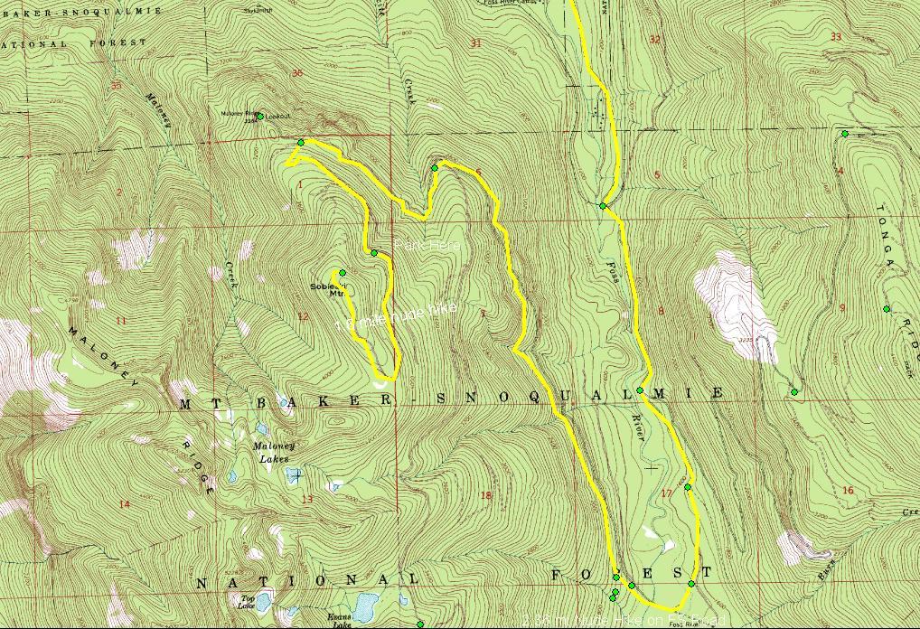
It's been a busy week with all this great weather . . . and I haven't been remiss in my hiking, plus fitting some time in there to visit LARC for the Music Fest last Saturday. The thrust of my explorations has been the Foss River Valley with a lot of little side trips exploring spur roads but three noteworthy hikes to:
  1. An unmarked and abandoned logging road up the west side overlooking the Foss River valley
  2. Sobeiski Mountain features a microwave tower at the top and overlooks Maloney Ridge
  3. Evans Lake, an easy, and popular, 1/4 mile hike to a small alpine lake and great camping places
The Foss River Road turnoff just past the Ranger Station on US 2, is mainly known for the Tonga Ridge trail access. I've explored beyond the spur road that takes you to Tonga Ridge and checked out a few areas at the far end of that FS road (which terminates at a blockaded bridge over Fisher Creek). That is the east side of the Tonga Ridge/Mt Sawyer Formation and until the deer flies disappear, I don't plan on anymore hikes in that area. This time, I explored the opportunities east and south of Tonga, all of whom are accessed by continuing to the right on FS 68 instead of taking FS 6820 on towards the Tonga.


A Gem of an unmarked logging road


There are lots of unmarked dirt and gravel roads leading off of FS 68 as you wend yourself into the wilderness. One such one I drove up quite distance to see where it went before I started getting nervous about being able to turn the car around on the narrow, unused tracks in the dirt. The first time I backed down almost half a mile close to the entrance until I found a place to park near a pretty creek coming down the hill. I spent some time exploring that area with the idea of doing a nude hike sometime in the future.
Exploring the burned-out core of an ancient tree

The second time I visited this area I again parked a couple hundred feet in near the creek and out of sight of the entrance. This time I was going to do the entire road and hike it nude wherever it took me. I had no idea since it didn't show up on my top maps. It was starting out to be a nice day with the morning chill beginning to burn off, so I stripped and took only a fanny pack and a hiking stick. And off I went, an easy stroll along the two tire ruts and a lane being edged in slowly by the bushes.

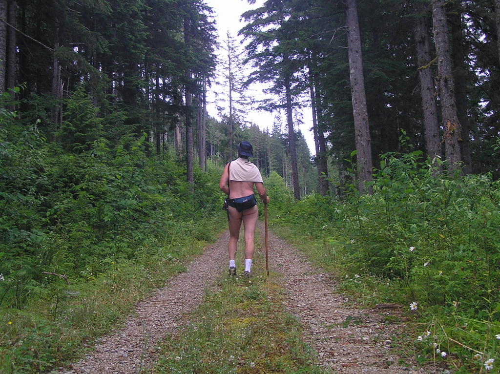
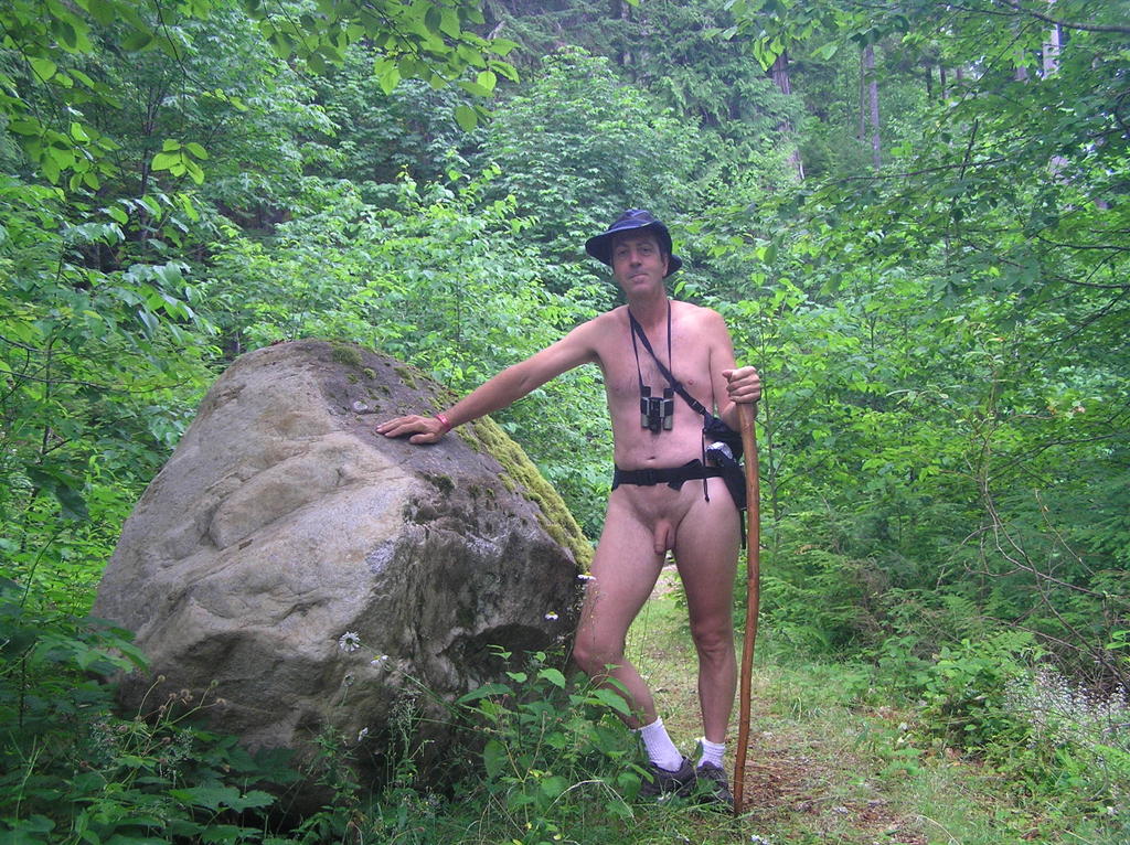
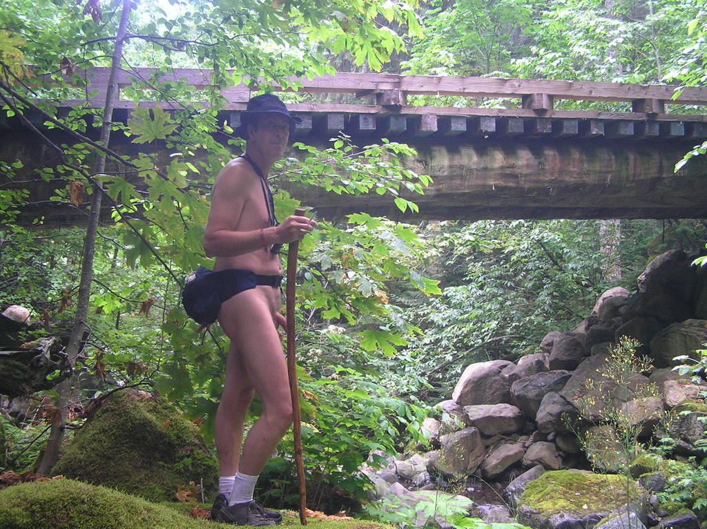
Heading up the logging road with just a fanny pack, a teeshirt over my shoulders against the morning chill, my hiking staff and, of course, my floppy blue hat


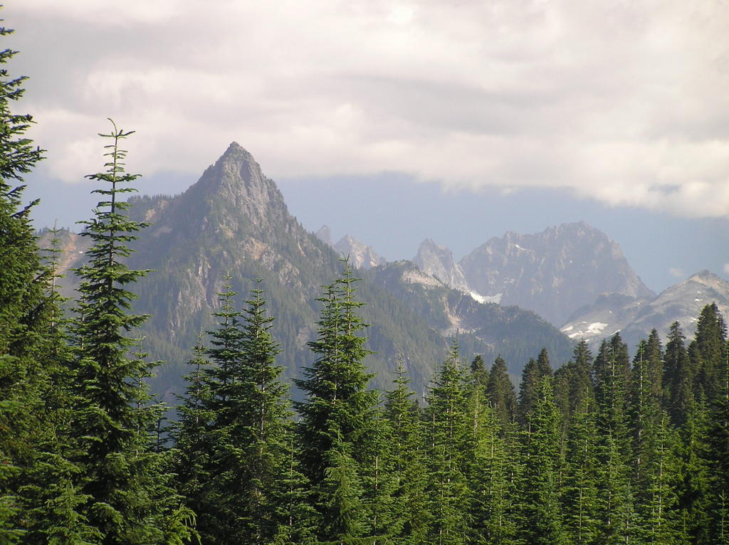
Reaching the end of this logging road through the couple of switchbacks through a number of grown-over clear-cut areas leads to some wonderful views of the Foss River Valley far below. If you look real carefully through binoculars you can make out the Foss River Campground at the confluence of the East and West branches of the river on the valley floor . . . and possibly make out a few tents. This road ends in a wide turnaround before a deep ravine. A few old campfires and numerous shotgun shells along with the typical discarded food wrappings show that the irresponsible have been up here in the past.

The hike back down is just and enjoyable and I spend a lot of time dawdling over ripening wild berries edging the side of the road. Down near the first switchback I get that edgy feeling again when I know a hike is drawing to a close and I have to get dressed again. Always happens to me. Not nervousness but a disappointment . . . something that makes me think about just turning around and hiking all the way to the top again. Anything to avoid that last stretch back to the car and the end of the hike.

This time, however, I go off the road toward the sound of rushing water over the slope. I can hear it and perhaps just make out evidence of the deep cut, but the forest is sly and thick here. I wonder . . . is it possible to approach the stream from below.

When I had headed up the road showed evidence of a real old track (two ruts) barely discernible Y-ing off just before the switchback. Here was my diversion. I hung and sharp right and headed down a completely overgrown old road toward the sound of the stream I have been looking for.
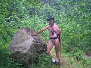
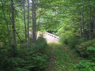
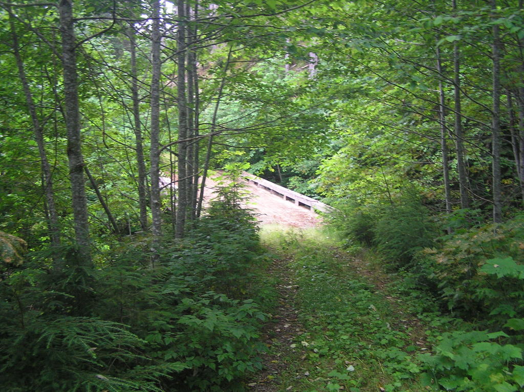
Imagine my surprise when I came to a wooden bridge, car width, out in the middle of nowhere. You couldn't see it from the road, the spur was something no one who think twice about exploring. Yet here was that bridge; in great shape . . . huge granite boulders sitting moss-covered in the middle . . . undisturbed for years.

The Forest Service has a habit of marking decommissioned and abandoned bridges with obvious markers. None to be seen. Was this road truly forgotten? It goes no where but a few hundred feet more through heavy brush and then peters out. But I have a creek and bridge to play with now. I love getting down into the streams and creeks. Then just fasinate me.
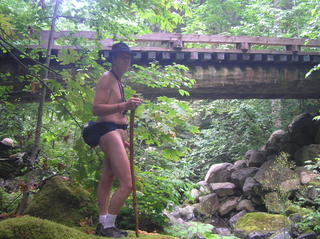
Eventually, I head back as the sun begins the wane and the bugs start looking for a meal. The last mile or so is sedate and quiet. My car comes into view and I know I've communed well with nature today.


How to get there:


Logging Road Over West Foss River Valley:
  • From the turnoff from US 2 onto the Foss River Road you will go over the Foss River on a one lane bridge t about one mile in.
  • You will pass under the BN RR trestle at 2.4 miles
  • At 3.5 miles, continue straight ahead on FS 68 (the right fork). The left fork is FS 6820 which leads up to the Tonga Ridge
  • Continue past the parking area for Trailhead 1064 at 4.1 miles
  • FS 68 curves back north, crossing a creek by a small bridge and then the Foss River by a second bridge at 5 miles
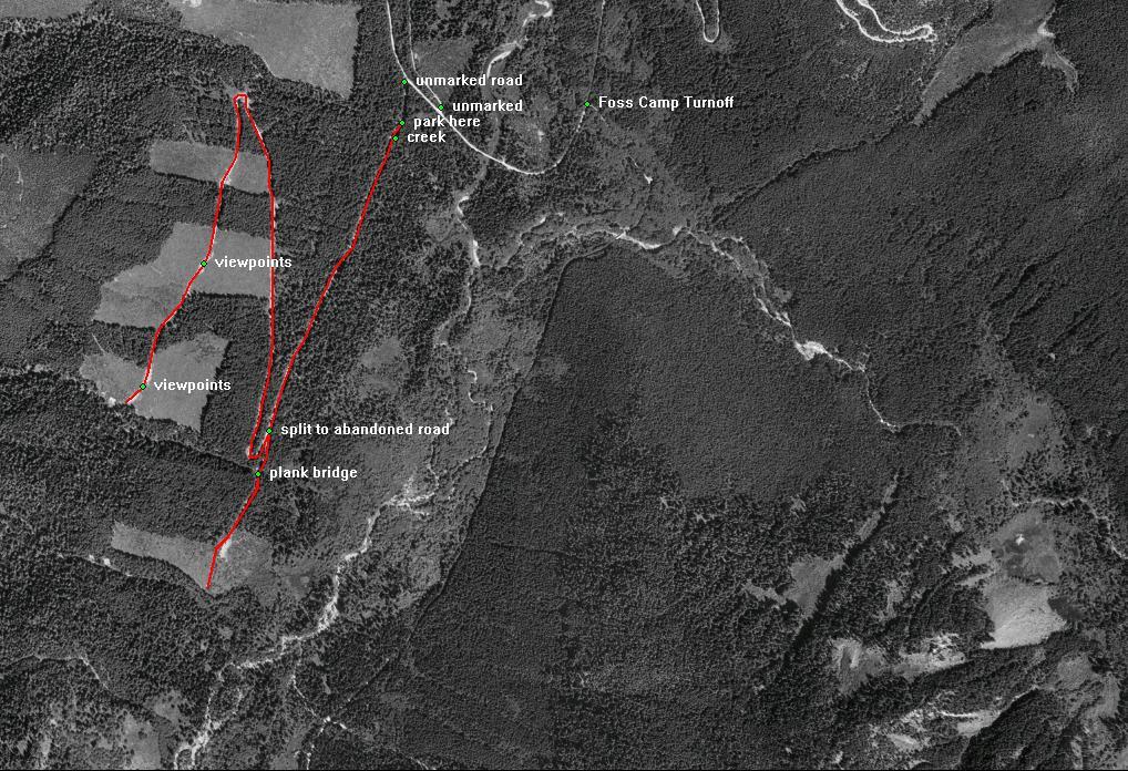
  • You will pass an unmarked abandoned dirt road on the right, closely followed by another unmarked narrow gravel road T-ing on the left at 5.25 miles.
  • Turn left on this road for about 500 ft and park just before the flood-sluice structure for the creek. It is possible to drive a considerable distance up this road and a 4x4 would have no trouble reaching the top. Best saved for hiking, though.
  • This hike is 6.5 miles round trip


Sobeiski Mountain Road

The peak named Sobeiski is just about at the end of FS 68 with the last major fork being the route to Maloney Lookout overlooking the Skykomish Valley and the town of Skykomish to the north. Of course, I hadn't really studied my maps that much when I set out on this adventure; I was just following the gravel road . . . soon to become a torn-up dirt road . . . to it's natural end somewhere deep in the wilderness between Highway 2 and Interstate 90. I guess I harbored some secret wish to shortcut the 35 mile length of the Stevens to Snoqualmie leg of the PCT by starting in perhaps halfway there to Snoqualmie Pass. No such luck. The road climbed steeply and eventually became just a little too rough for my Civic to easily continue. So I parked, thought about it and then decided to hike as far as I could on this remote road. In the distance I could see a microwave tower and already had some inkling that that was where this road lead. Off I went sans clothing and enjoying the bright sunlight on the open slopes.


Turn the car around to point downhill as this is as far as I can safely drive. Now it's time to enjoy a hike!
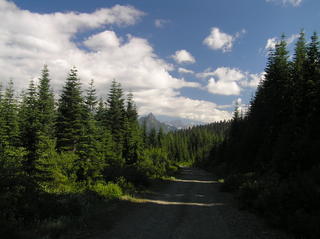

Perfect hiking weather and a complete sense that you have this all to yourself
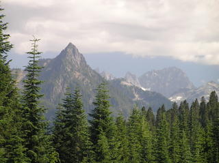

I believe it is called Cathedral Rock, a prominent outcropping south as I approach the top of Sobeiski


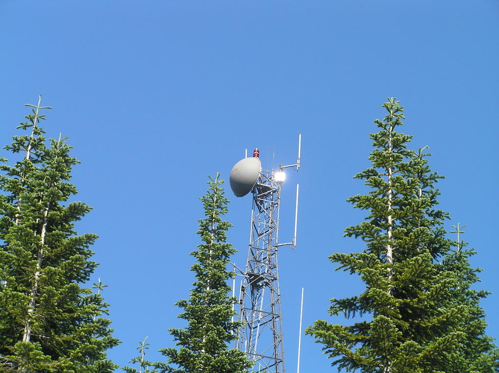
The microwave tower atop the peak is completely automated. On several sides you can see the fiber-optic cable snaking their own perilous route up the steep slopes.


There is lots of space atop Sobeiski . . . certainly flat camping areas and fire-rings that indicate this is a popular camping place, although the pits seem disused for some time.

On the northern-facing side is a great view of the Skykomish Valley twenty miles down and north. In the distance is the Glacier Peak Wilderness. The dirt road circles around the high, treed mound on which the tower sits and then rejoins the road I just came up on. It's a long time before I feel any need to head back down.
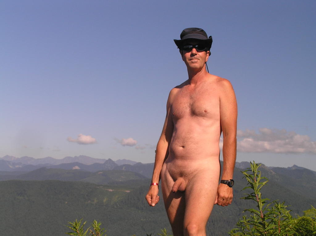
Okay, I admit I'm a bit narcistic about myself in this pic. My tan is developing nicely, I feel healthy and good about myself and this picture reminds me of that. I'm truly at the top of the world!


How to get there:


Logging Road Over West Foss River Valley:
  • From the turnoff from US 2 onto the Foss River Road you will go over the Foss River on a one lane bridge to about one mile in.
  • You will pass under the BN RR trestle at 2.4 miles
  • At 3.5 miles, continue straight ahead on FS 68 (the right fork). The left fork is FS 6820 which leads up to the Tonga Ridge
  • Continue past the parking area for Trailhead 1064 at 4.1 miles
  • FS 68 curves back north, crossing a creek by a small bridge and then the Foss River by a second bridge at 5 miles
  • Continue past the previous unmarked road at 5.25 miles. At 8 miles is the Y of the Evans Lake Road to the left. Continue on FS 68 to the right.
  • At 9.1 miles take left fork (right continues to Maloney Lookout)
  • You can safely drive about a mile up this road. Find a spot to safely pull over and park and begin your nude hike from here, which leave about a 3-4 miles round trip nude hike, mostly in full sunlight.


Evans Lake


The third hike is to the very popular Evans Lake Trail . . .


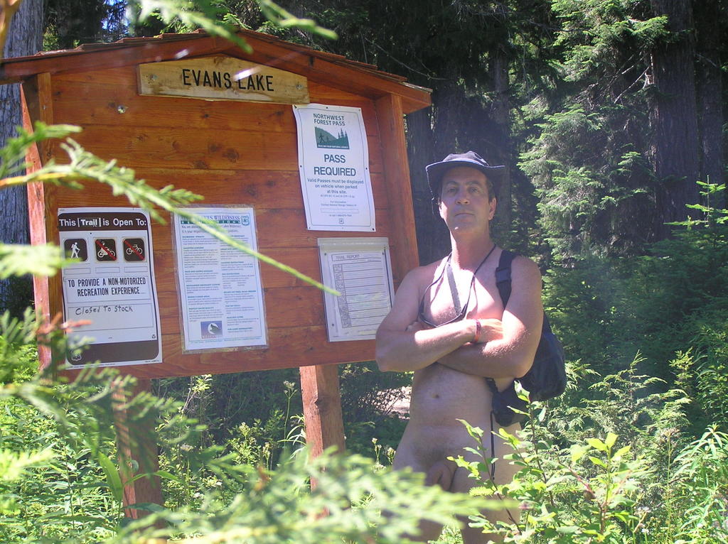
Heck, you knew I was going to pose with the trailhead sign, didn't you?

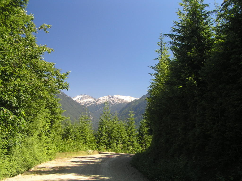
I didn't know what to expect of Evans Lake as it's touted as an extremely easy trail suitable for all ages from children to seniors. But this was a weekday so I figured maybe I might have it to myself. So off I went, driving naked up the miles of Forest Service roads to the small siding that served as the parking area for the trailhead. I missed it the first time and continued another half mile up to the end of the road. The signage is off-road but obvious once you see it. Along the way you have some extraordinary views of the Necklace calderas facing the Tonga Ridge to the northeast.
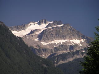
This view is alongside the FS road about halfway up

There were no cars in the siding so I felt confident about hiking in nude. I few pesky deer flies this high up on a hot, sunny weekday but not anything I couldn't handle. The trail is a short, level stroll of a quarter of a mile to the lake . . . and possibly another quarter mile in narrower trails around the lake. The lake, itself, is rather small but scenically nestled between the close steep slopes of the nearby peaks.
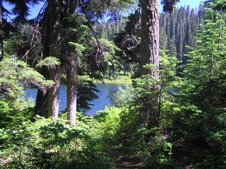
Lake Evans is shallow and perhaps an acre in size

Reaching the lake, the trail becomes a scramble to the right perhaps a third of the way around the lake, over fallen trees and encroaching blackberry bushes. It is in the southern side of this lake (to the right) where you find all the idyllic camping spots. I spent a lot of time sunning in these areas or just relaxing.

The return drive down presented those stunning views of still snow-caps peaks south of Tonga . . . better yet, I got to drive the 8 miles back naked.

The aptly-named Jewel Peaks

Friday, July 29, 2005

Humor: Advice to nude smokers

Ah, what the heck . . . we need some humor . . .

Taken shamelessly from Everything.com

If you are a habitual smoker, or even a casual smoker, eventually a situation will arise where you are without the protection of clothing and desiring a cigarette. This can be a dangerous situation. There are precautions you must take that under other circumstances would not be as necessary. Often a jittery smoker will grab a bathrobe or quickly slip into filthy, disease carrying clothes they find on the floor. This is not necessary! You can smoke in the nude in relative safety provided you follow some simple, common sense rules!

There are many situations that arise where smoking and nudity are common occurances. Nudist colonies, nude beaches and nudist groups often admit smokers and post stringent rules about how one must enjoy fine tobacco products. There are people who rarely wear clothes in the privacy of their own homes and choose to enjoy fine tobacco products. Those who are experienced rarely need rules pointed out to them. They have often learned via their own errors in judgment.

There are also special situations in which an average Joe might find themselves naked and desiring a fine tobacco product. You might be taking a long bath, in which case the water in the tub provides a natural insulation against ash and flaming debris. The most important rule in any such situation is to be careful. Remember that your bare skin is opposed to being burned and that the primary reason clothing was invented was to protect our beautiful bodies from flaming tobacco products.

Of course there are other forms of fine tobacco than the common cigarette. There are other products which can be smoked when one is naked. Special caution must be taken with a pipe and only experienced pipe smokers should smoke a pipe while naked. One who is not experienced in the ways of the tobacco pipe may find much ash and flaming debris flying into the air, especially if one accidently exhales with the pipe in one's mouth. A cigar is also very dangerous to smoke when nude as one does not "flick" the ash and the volume of potential flaming debris is increased, especially if it is a cheap cigar. Products such as marijuana cigarettes are very popular with nude smokers and carry their own dangers. Smoking of marijuana may make it difficult to concentrate on the fate of ash and flaming debris. Depending on the quality of product and the ability of the marijuana cigarette roller, you may experience great danger to your exposed body. A pipe, bong, or other smoking apparatus may be better when one chooses not to wear clothing.

Just be careful out there. Someone might be watching. They might be crazy. They might be armed.

Saturday, July 23, 2005

First Aid: Are You Prepared? Aiding a fellow hiker

I hike an awful lot au' natural. I carry as little as I possibly can. After all, that is the idea behind nude hiking, isn't it? But one thing I never hike without is at least a rudimentary first aid kit for the trail that can address the most common incidents that can happen. When you are hiking miles from assistance or help, you'd be negligent . . . if not also stupid . . . to at least take care of minor injuries like cuts and scrapes, insect bites and the like. But have you ever given thought to more serious accidents and just how you would address them. My small kit came in handy today, along with a little bit of judicious thought of the few small items I do carry that can perform additional services.

The Martha Lake Trail is a reasonably short trail with a pretty alpine lake as it's destination. Two miles in and two out. It can be popular except for the very rough hiking situation that has seen Search and Rescue vans at the trailhead a number of times. Today I started out late . . . one vehicle at the trailhead. Plenty of forewarning on this trail so I hiked in nude expecting an enjoyable hike, some time in the sun at the lake, and out by dusk. I made the lake in just under two hours and started to search for an area to bask for a while before heading back. That's when I saw two young women hikers on the other side of the lake waving their hands in an unmistakable frantic way. I wave back and started heading their way, which took sometime on the tricky and narrow, skree-strewn path. (yes, I did put my shorts on)

When I arrived, one of them was in obvious pain, sitting down and babying an unshod foot . . . the tennis sneaker sitting a foot or so away. The girl's ankle was already pretty well swollen . . . there was no way we were going to get her sneaker back on now. I asked what had happened and I was told she'd gone wading in the shallows and stepped on a hidden snag . . . and now she couldn't put weight on her foot without a lot of excrutiating pain. Should have left that shoe on but that's spilt milk now. The real problem would be how to get her out of there before nightfall.

The considerations during a debilitating (or worse) injury far from reasonably-timed aid is whether to send for that aid or make an attempt to get out under your own power. Cell phones don't work in this valley, nor do they connect at the trailhead. It was a two hour hike back (at best), another hour to the nearest phone and an equal amount of time to return with aid. Six hours and it's already four o'clock. It would be well past dark before any help would be forthcoming. Too much time for these inexperienced girls. They were already panicking over thoughts of bears and mountain loins and darkness. They'd freak! If I could stabilize her foot, it was worth a try at hiking out ourselves.

The first aid kit was, of course, worthless. Bandaids, tweezers and a few gauze pads didn't add up to much. But I always carry a roll of 1 1/2" sports tape . . . the stretch-type that clings to itself . . . because I've twisted ankles before and I know how handy this stuff is, either as a wound bandage or a support wrap.

First order of business, wrap her ankle securely . . . leaving the toes exposed to keep a check on circulation. Then cinch up her other shoe to give her reliable footing on the way back. I had her friend massage her calf muscles (more to reassure them than anything else) while I searched out a good hiking stick for the girl. Then we got her up and did some test walks. It would work if we took it slow. Since I'd come in with only a fanny pack, I shouldered the girls daypack. We got her up on one leg between us, her arms over our shoulders. Slowly, we made it back around the lake to the safer trail leading down and out . . . a place where she could use the walking stick and only myself for support while her friend led on the narrow trail.

It was slow work. We stopped frequently to rest and raise her foot, check the circulation and then encourage her on. At several points I considered carrying her piggy-back but the trail didn't allow for that except at the two stream-crossings we had to make.

Nightfall hit us. I hadn't planned on a night hike but I still carry my headlamp. Out it came and now I had two very scared girls hovering close for physical reassurance. I don't particularly like to hike in the dark and I'm experienced. I could imagine the things going through their minds everytime the wind rustled a bush nearby in the darkness. We slowed down considerably, staying within the bright cone of illumination.

It was almost ten by the time we made the trailhead and I hobbled them over to the safety of their car. I rechecked the wrapping and told her friend not to worry . . . drive normally and stop by an emergency room on the way home just to be sure. They begged me not to leave until they were ready so they could follow me out. I promised with a smile. A while later, we turned onto Highway 2 westbound. They stayed behind me all the way to Monroe where they turned off.

The nice thing . . . I got a phone call a little while ago to thank me again and let me know that she just had a severe sprain, nothing broken, and would be okay (which is why I'm writing this small piece). The other nice thing? Would I go hiking with them some time? It's nice to help people and to be thanked. It's nice to make friends. Makes your day.

Tuesday, July 19, 2005

Deer Flies have Hatched

The Deer Flies Are Biting

I started out on a long anticipated nude backpacking trip to Deception Lake today and lasted all of fifteen minutes. I didn't even make the trail entrance. The moment I stepped from my car I thought I'd stepped into a hornets nest as dozens and dozens of large buzzing deer flies homed in on me and my car. The first of the season and it was a miserable moment as I stood there swinging my shorts around my head to push the insistent pests away.
[Image Source: Wikipedia]


I wasn't prepared for deer flies and their related cousins, the horse fly. Citronella does not work on them and DEET, though effective against mosquitoes, does nothing to discourage deer flies. These nasty critters can impart a nasty bite (the female is the bloodsucker . . . the male more civilized, or whimpish, as you prefer) as they suck your blood for a protein meal.

Like mosquitoes, they are attracted from hundreds of feet away by the carbon dioxide and lactic acid we exhale (which also explains why they had this affinity for the exhaust coming out of my cars tailpipe . . . carbon dioxide). In any case, within moments there were hundreds of these things buzzing around me and a naked hike was out of the question. It was all I could do to duck back into the car and listen to them impact against the windows. Nasty critters!

You find them everywhere . . . forests, meadows, roadsides. I noticed that they seem to prefer the sunnier areas (though I won't swear by that), and on the drive back down the mountain deer flies seemed to drop off below 3,600 feet. A little research indicates the deer fly is territorial and prone to locale. The west side of Mt Sawyer was deer-fly-free, so there may be some truth to this. The west side of Mt Sawyer is bereft of slower moving streams and wet areas, as well; and deer flies need a moist area to lay their eggs.

In a nutshell:

  • Deer Flies and Horse Flies pupate into adults once a year in the summer months and live as adults for 60 to 90 days.
  • The adults are attracted to dark, moving objects and the carbon dioxide we exhale and emit from the tailpipes of our cars.
  • The female Deer and Horse Flies bite with scissors-like mandibles and drink the blood from the bite. The bite can be extremely painful and some people may suffer an allergic reaction to the injected saliva that is intended to prevent coagulation.
  • Deer Flies favor the head, particularly under the brim of a hat. They will swarm the head and attack five or six at a time.
  • Horse Flies favor the legs and will attempt to attack with two or three flies at a time.
  • Deer Flies and Horse Flies will rest in grasses or bushes and swarm when they detect a victim. They are strong fliers and will aggressively follow a car for a considerable distance.

Additional information on the various biting flies can be found at the Colorado State University Cooperative Extension.

REI has the only product I know of that is effective against biting flies such as the Deer and Horse Fly.

To quote the product literature:

Sawyer Broad Spectrum Spray

For skin application. While Deet can repel all mosquitoes, ticks, and some flies, Deet does not repel all flies effectively. For those situations you will need the extra protection of the special fly repellent, R-326, which is added to this formula and is effective against flies, gnats and no-see-ums. For times when sprays are more convenient than lotions, this is the formula to use. Sawyer's Broad Spectrum contains no alcohol which has been shown to increase skin absorption of Deet, and is the only non-alcohol spray repellent in the USA.

You can order it online here, or pick up a bottle at the downtown REI for $5.95

Related Posts with Thumbnails