
Nude Hike thru clearcut to Deer Creek Flats
 |
| GPS track of Reiter Ridge-Deer Creek Flats hike |
No snow hikes (nude or otherwise) for me this year as my metabolism has not been able to take the cold. So it was a treat for me to finally get out on a sunny day and enjoy some six or seven hours of sunshine and warmth with a nude hike from Reiter Ridge near Goldbar to Deer Creek Flats above the town of Index.
 |
| Road closure of the Old Reiter Index Road |
Reiter Road is (or was) the backdoor way into the town of Index if you wanted to enjoy scenery, a twisting, scenic backcountry road, and access to activities missed by taking the US 2 highway route. Reiter Road winds up the north side of the combined Skykomish River onto a ridge before dropping back down into the town of Index. Most of the land adjacent is DNR land (Department of Natural Resources). These areas have been extremely popular in past years for off-road vehicle riding areas. There are dirt roads, tracks, and sometimes less than tracks torn up in the area. There are also a number of mining claims within the DNR lands. The popularity of the area, the number of dirt bikes . . . and proximity to populated areas has taken a toll and the Reiter Ridge ORV Recreation area has been closed to all use but walkin traffic for the past two years. Last year, portions of the Reiter Road suffered major damage and that road (and access) has also been closed. The entire Reiter Ridge area is under restoration. Little use is seen nowadays (except for fishermen heading up to Lake Isabel) . . . . and that makes this area a prime venue for some unhampered nude hiking.
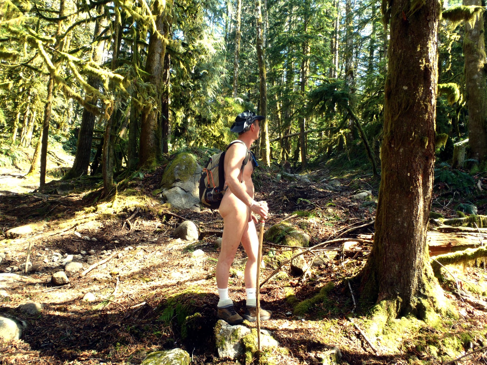
 |
| In the clearcuts of Reiter Ridge |
Restoration involves mainly stream restoration and reversion of much of the damage done by ORVs tearing numerous tracks through the undergrowth of the forest canopy. A major BPA corridor cuts a wide swath of clearcut across the ridge but hiking the length of that corridor is piecemeal because of the numerous closures where streams are under restoration. To get to the next major section of clearcut one has to travel down Reiter Road to the next access point. But now, Reiter Road is closed. I could do it on foot but hiking nude on a paved county road (even if it is closed) . . . in Snohomish County . . . is tempting fate just a little bit too much (not that I haven't done so for short distances). Still, there are enough gun-toting yehoos out and about violating road closures that I don't think it is a good idea (the county has also seen it prudent to post dozens of No Shooting by County Ordinance signs in recognition of the problem. I'd much rather find a way around the fenced off restoration areas by heading into the wild and around. That has been the subject of a few exploratory hikes prior to this one.
 |
| Exploring what looks like a jeep trail into the canopy above the BPA clearcut |
Hiking in at this particular access point leaves one in the open right from the start . . . and you can tell from the excellent maintenance of the road, the litter of spent shotgun casings, and the recent indentations of horseshoe tracks that this area does see some use. But there is only room for one or two cars so I feel pretty good about stripping right at the car and hiking in nude from the get-go. After all, my body has been starving for it's share of vitamin D.
The good section of road does not last long . . . just to the first set of BPA towers. Then it degenerates into cobble and erosion . . . always a welcome sign to anyone who wants solitude. There is plenty to enjoy. Sun and a light breeze for sure, but also signs of wildlife, though not seen, certainly noted. Plenty of deer track as the deer favor the handy access roads to travel across slopes. Also fox (or some small canine) as well as the tracks of feline showing no claws. Closer to the uphill sides of the clearcut are unmistakable signs of recent bear tracks . . . whose reversed thumbs give unmistakable identification.
Part way in the dirt track does a short loop into the canopy to get around a steep ravine or cut. It is at the apex of this cut that what looks like a continuation into the canopy intrigues me enough to set off into the woods rather than the clearcut twenty-five feet away. A hundred feet in and it becomes obvious that this is a trail . . . and it is wide enough to have been a jeep track at some time. Horseshoe tracks into the soft mud confirm my suspicions. This trail goes somewhere. It's not on the maps but by a quarter miles into the canopy I'm on road surface that has been there for a long time and is relatively level and easy to travel.
 |
| Upper Austin Creek and that easy way around |
I lose the trail a couple of times and have to backtrack numerous wide spaces until the ravages of nature no longer obscure the route. At one point I have to descend into a slow-running creek bed only to figure out that the creek is the road . . . or what is left of it. Then I come up to orange construction fencing . . . the same stuff that is blocking the wide spread of wetland below. What the heck . . . around it I go because now I know I'm on the other side . . . if I can find a trail or path back down to the clearcut. Across a dicey, rotten old log bridge and I eventually find a trail. It's back into the full sunlight of mid-afternoon. Ahead of me is a steep clamber up to the top of the ridge and Deer Creek Flats.
 |
| Atop the ridge |
This section of the clearcut is steep and seriously eroded. Only ATVs would make it up this far . . . and not all the way. On foot it's a scrabble but I soon gain the ridge only to be surprised by a very well maintain (and used) gravel road . . . and I pause a moment below the edge before I cross it . . . fully expecting cars to come by. I gain the other side . . . on a crown before the final crest and peruse my topos. It's FS 6010, inaccessible at the other end because of the Reiter Road closure . . . though the fresh tire tracks mean somebody has been up this way, and recently. The muddy water in a nearby pothole is occluded from that travel. FS 6010 doesn't seem to go anywhere much except up onto the flats, with a side loop to a major, automated radio facility.
I climb to the crest and gaze out over the sheer drop east toward the Skykomish North Fork valley near Index. At the crest is another memorial for someone whom I suppose had an accident off-roading these rough roads. It's while I'm taking pictures of the cross and memorial that I hear the unmistakable sound of metal clanging on metal . . . and it is very nearby in the canopy to my right. At first I ignore it by it starts up again. I head in that direction, come across a neatly-folded denim jacket sitting on the side of the ridge and hear the unmistakable sound of a heavy hammer on metal. Then I spot him . . . fifty feet down an eighty degree slope . . . in dense underbrush is this guy banging away at a discarded oven-stove, ripping it apart. It is so weird that I don't even think to cover up. I ask him how he's doing . . . catch him off-guard.
He states he's scavenging metal and I reply "up here?". Weird. He hiked in from the steep side and was stripping electrical wire to cart all the way back down. I left him to his devices, shaking my head,
I followed FS 6010 in for about half a mile before I decided to turn back before I lost the sun. Partway down I spotted another cross and memorial which also marked another track back into the canopy to explore . . . which I did. Eventually I ended up on the right side of the closed area and back onto the familiar access roads.
 |
| Heading back down to the car |
Of course, we always linger when we near the end of our hikes. One thought that was going through my head was the debate of when I would stop and put on shorts . . . because the curve at the bottom and the paved county road was coming up quick. Eventually I just walked up to the gate . . . got one last picture, and then walked up to the car to fish my keys out of the small case across my torso . . . thinking to myself that this would be a bad time for someone to come driving down the road.
Yep . . . someone did and with the door half open and the pack slipping off my back, an SUV appears around the asphalt bend and pulls in neatly behind me. LOL . . . grin and bear it. Turns out that the middle-aged woman was headed inbound to do some cleaning and restoration of her own on her brother's memorial just a ways up the access road. If my nudity fazed her it was not apparent. We had a nice little chat and then off she went with garden shovel in hand to do her thing. I got dressed before anyone else showed up. What a great hike!
The photo album of this hike is here: Nude Hike to Deer Creek Flat album


|