
Goldmyer Hot Springs: Update
From: Beth
On November 7th/8th, the latest 'Pineapple Express' flood, with it's record breaking rainfall, turned all of the river valleys and low lying lands in Western Washington into raging torrents. At Goldmyer, the caretakers, who live on the property, had an experience of a lifetime being able to observe the full force of Ma Nature! The streams and rivers flowed brown with mud and debris. They roared with crashing boulders being swept downstream. The hotspring cave and outside hot pools remained intact, and the water is still good and hot.
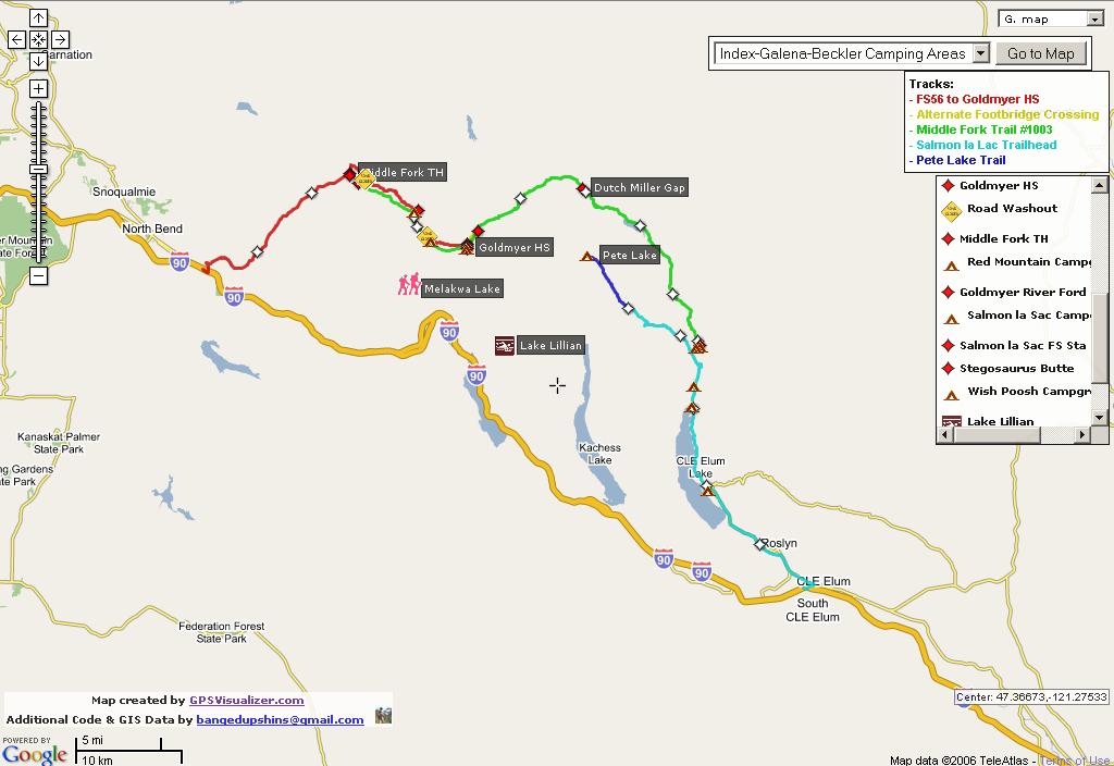
The Middle Fork Road sustained major damage in one area. About 2 miles before the traditional river ford, a side channel of the river literally washed away the road in a couple of spots. The Forest Service already has a contractor working along the road repairing smaller washouts on their way towards the big washout. The FS has just closed the gate at the Dingford Trailhead, because of concerns of vandalism to the road repair machinery up above. They don't know how long it will take to complete repairs.
Additionally, at the traditional Goldmyer river ford, the force of the river during the peak of the flood was so great that it washed away numerous boulders that used to line the river bottom. If you're experienced at crossing the river there, you will find it deeper than it was before because of the pockets left behind where the boulders used to be. The big tree stump that sat in the river at the ford for about 15 years is gone.
The section of Burntboot Creek by the Goldmyer campsites widened it's channel during the flood, and swept away a couple of our campsites. On the other side of the Creek, and heading downstream, an long stretch of the Middle Fork Trail was washed away. These changes will make it more difficult for hikers coming up from the lower section of the Middle Fork Trail to find where to ford Burntboot Creek and to find the continuing trail on the Goldmyer side.
For the time being, access distances to Goldmyer are:
1) Dingford trailhead is about 4-1/4 miles (each way) to the river ford, if hiking or biking along the road. The MF river might or might not be low enough to ford this time of year, with continued rainfall, and the changed river bottom. Please use your common sense!
2) Hiking in along the lower stretch of Middle Fork Trail from the Dingford Trailhead is about 5 miles (each way), but it requires fording a number of moderate sized creeks and Burntboot Creek (which is more of a 'river' than a 'creek').
3) The only way to get to Goldmyer without having to ford a river is to use the upper end of the Middle Fork Trail, which is located farther up valley beyond Goldmyer. From Dingford Trailhead, this is appoximately 10 miles (each way).
For those who enjoy a more challenging access, the reward is fewer folks using the hotsprings!!
Be prepared and be sensible.
Be prepared and be sensible.
To aid in setting references points, here is the Interactive Map I have of the area:


|