Saturday, June 10, 2006

NAC Alert: California: American River


NATURIST ACTION COMMITTEE
ACTION ALERT


http://www.naturistaction.org


Copyright 2005 by the Naturist Action Committee, which is responsible for its content. Permission is granted for the posting, forwarding or redistribution of this message, provided that it is reproduced in its entirety and without alteration.

DATE : June 10, 2006
SUBJECT: California: American River
TO : Naturists and other concerned citizens

Dear Naturist,

This is an Action Alert from the Naturist Action Committee concerning an important situation in the state of California.

NAC has learned of a plan by California Park managers to force an abrupt end to traditional clothing-optional use along a portion of the American River near Auburn, California. NAC is asking for your immediate action in the form of:

1) your letters to key California Parks personnel, and
2) your attendance at an important public workshop on June 15.


WHAT'S THE SPECIFIC THREAT?

Rangers from the State of California Department of Parks and Recreation have indicated that nudity will no longer be permitted on the river near Auburn, and that signs banning nudity will be posted in the area on or about August 1, 2006.


HISTORY AND DISCUSSION

Skinny-dipping and nude sunbathing are a decades-old tradition on the American River. The clothing-optional sites most directly affected by the proposed action are located northeast of the town of Auburn, below the confluence of the North and Middle branches of the River and above the site of the indefinitely delayed Auburn Dam on the American River.

THE DAM The dam plays a key role in this situation. As designed by the U.S. Bureau of Reclamation, the enormous 685-foot high structure would be the largest concrete dam of its kind, larger than Hoover Dam. The water it would impound would inundate more than 35,000 acres. Congress authorized the dam in 1965, and preliminary site preparation began in 1967. That included construction of a diversion tunnel to take the river's water around the dam site. River rafters were forced to remove their craft at the Highway 49 bridge, near the confluence of the river branches, more than 3 miles upstream from the dam site.

Excavation of the dam foundation began in 1974. In 1975, however, an earthquake of magnitude 5.7 struck just 45 miles away. Geologists determined that the quake involved the same fault system that runs under the dam site. Engineers who designed the dam admitted that it had not been designed to withstand such a quake. The authorization for the project remained, but funding for the dam was withdrawn and construction was stopped.

The dam project remains in limbo. The American River area it would affect remains funded by the Bureau of Reclamation, and under a 1977 contract, it has been operated by California State Parks as the Auburn State Recreation Area (SRA). Meanwhile, since 1977, generations of Californians and others have continued the tradition of nude recreation along the river.

THE LAW Section 314.1 of State Penal Code is the portion of general state law used to charge indecent exposure, but California courts have said that absent any lewd content, benign nudity like skinny-dipping is not prohibited under 314.1. Title 14, Section 4322 of the California Administrative Code bans nudity in State Park units. However, well established State Parks policy and court decisions have limited restrictions on nudity in traditional areas of clothing-optional use, and Section 4322 itself allows for the creation of areas within state parks to be set aside officially for clothing-optional use. Historically, California Parks personnel have not hassled people for mere nudity along the American River, unless a specific complaint has forced them to respond.

Despite a recent effort to force resumption of the dam construction, there has been even great pressure to plug the bypass tunnel and return the river to its channel. California Parks and the Bureau of Reclamation will initiate exactly that action this year, and with input from the public, the agencies will be developing a joint General Management Plan for moving forward.

THE PROBLEM Auburn SRA Superintendent Jay Galloway has determined that the return of rafters to section of the river below the Highway 49 bridge and above the old dam site means that the skinny-dippers must go. He intends to post signage banning nudity in the traditional clothing-optional areas and will instruct rangers to begin arresting those who do not comply.

Superintendent Galloway has declared that since naturists are "breaking the law," they will not be considered stakeholders in the development of the General Management Plan, and their attempts at participation and input will be ignored.


WHAT IS NAC DOING?

The Naturist Action Committee has let Superintendent Galloway and California Parks know very clearly that naturists will NOT be ignored. The contemplated prohibition against nude recreation at traditional clothing-optional sites in the Auburn State Recreation Area violates established California Parks policy (the Cahill Policy).

NAC has also informed Superintendent Galloway and California Parks that the proposed action contravenes established state case law (California v. Bost), which addressed a case in Placer County, the very county in which the traditional clothing-optional sites on the American River are located.


WHAT IS NAC ASKING YOU TO DO?

The Naturist Action Committee is asking you to do TWO things:

1) Write immediately to the California Parks officials responsible for the Auburn State Recreation Area.

2) Attend an important public workshop on June 15 to establish parameters for a General Plan/Resource Management Plan for the Auburn State Recreation Area (SRA). The Plan is to be developed and released jointly by California Parks and the Bureau of Reclamation.

IMPORTANT: The hearing is scheduled for JUNE 15, so it's necessary for you to take action quickly.


WHO SHOULD WRITE

NAC is asking ALL NATURISTS and other concerned individuals to write, regardless of your residence. The area at issue is U.S. public land being administered as a California public park. This is a matter that affects us all.


WHOM TO CONTACT

In this instance, phone calls and e-mails are likely to be ineffective, since they can easily go unreported. Please write to ALL THREE of the following key individuals.

Scott Nakaji
Gold Fields District Superintendent
California State Parks
7806 Folsom Auburn Road
Folsom, CA 95630

Jay Galloway
Auburn Sector Superintendent
California State Parks
501 El Dorado
Auburn, CA 95604

Jim Micheaels
Project Manager
California State Parks
Gold Fields District
7806 Folsom-Auburn Road
Folsom, CA 95630


Key points to remember when writing:

1. Identify yourself. Anonymous correspondence is generally disregarded. If you are a California resident, please say so prominently.

2. Be brief and polite.

3. Say clearly and specifically that you OPPOSE any move to ban skinny-dipping and nude sunbathing on the American River.

4. Say clearly and specifically that you OPPOSE the attempt to remove skinny-dippers and nude sunbathers from the public discussion.


WHAT ELSE TO SAY?

Here are some additional points to consider:

1. Clothing-optional use at traditional sites on the river is an environmentally friendly, low impact use of the resource.

2. Naturists are responsible stewards of public lands.

3. Skinny-dippers are not lawbreakers under the conditions present in the Auburn SRA. California law does not criminalize mere nudity in the absence of lewd behavior. The California Administrative Code, California Parks policy and the rulings of California courts have established specific accommodations for clothing-optional recreation in traditional areas like those in the Auburn SRA along the American River.

4. User conflicts, if any, are best resolved by informational signage and user group cooperation, not by the arbitrary elimination of one group of users.

5. Successful models and precedents already exist for accommodation of clothing-optional recreation as part of a diverse array of uses in other California Parks units, viz., Torrey Pines (Black's Beach), San Onofre, Grey Whale Cove.


VERY IMPORTANT: ATTEND THE PUBLIC WORKSHOP

Date : June 15, 2006
Time : 6 ­ 9 pm
Location: Canyon View Community Center
471 Maidu Drive
Auburn, CA 95603

This is one of only three public workshops planned during the preparation of a General Management Plan for the Auburn State Recreational Area. Of the three workshops, this is the most important because it will establish the key issues, opportunities and constraints for the entire Plan. It is crucial that naturists and their interests are NOT ignored in this public process.

Even if you do not intend to speak at the Public Workshop, your presence is important as support for those who will be speaking on behalf of naturists.

IF YOU SPEAK AT THE WORKSHOP It's perfectly natural that you should be outraged at attempts to exclude naturists from public lands, and even from the process that plans the future of the resource! Nevertheless, if you speak at the workshop, you must avoid making personal attacks, even though it's hard not take the entire matter personally. If you like, you may make use of the points offered above for those who will be writing.


MORE INFORMATION AND RESOURCES

Additional information and links are available, along with this NAC Action Alert on the web site of the Naturist Action Committee.


http://www.naturistaction.org

Select "Alerts" and find this NAC Action Alert under Current Alerts.


PLEASE HELP NAC TO CONTINUE HELPING NATURISTS!

The Naturist Action Committee is a volunteer nonprofit organization that exists to advance and protect the rights of naturists throughout North America. Fighting for the clothing-optional recreational use of public land is expensive. To do its job, NAC relies entirely on the voluntary generosity of supporters like you. To donate to NAC, use the address below

NAC
PO Box 132
Oshkosh, WI 54903

Or call toll free (800) 886-7230 to donate by phone using your MasterCard, Visa or Discover Card. Or use your credit card to make a convenient online donation: www.naturistaction.org/donate/

Thank you for choosing to make a difference.

Naturally,

R. Allen Baylis
Don Stanton
Board Members
Naturist Action Committee

---------------------------------------------------------------
Naturist Action Committee (NAC) - PO Box 132, Oshkosh, WI 54903
Executive Dir. Bob Morton - execdir@naturistaction.org
Board Member Allen Baylis - rab@baylislaw.com
Board Member Don Stanton - dfs1@comcast.net
Online Rep. Dennis Kirkpatrick - naturist@sunclad.com
---------------------------------------------------------------

Sunday, June 4, 2006

Bridal Veil Falls

Originally hike May 2nd, 2006 and just now getting around to posting the report

Bridal Veil Falls is probablly the most photographed waterfalls in Washington State . . . most often photographed at a distance from the Espresso Stop on Highway 2 just past the Index turnoff. The falls are spectacular from this vantage point and they make a great latte there. You can also hobnob with Sasquatch, take a rest break or enjoy camping or a picnic surrounded by the majestic snow-covered spire-like peak of Mt Index and the waterfalls. I always stop here for my last chance at a good cu of coffee before trapsing off into the wilderness. I've also always wanted to take the hike on up to the falls and see them close up. Got my chance Tuesday, another fine sunny day in the Puget Sound area.

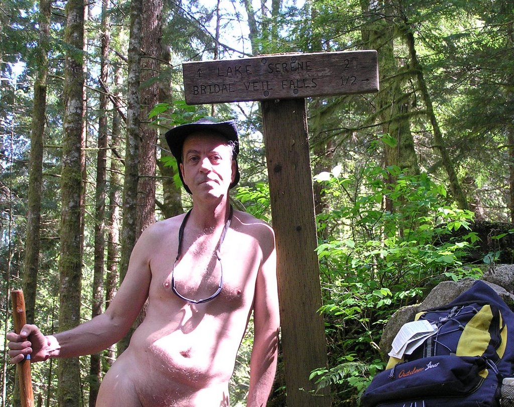
Bridal Veil Falls is actually a series of major waterfalls fed from Lake Serene near the top of Mount Index. The hike to the middle set of falls is a steep 1/2 mile spur trail off the Lake Serene trail. I didn't have enough time for Lake Serene but I could take a look-see at the Falls, themselves. The trail is one of the most visited ones in the Skykomish Ranger District but on a Tuesday, I figured I'd try it nude. There were no cars at the trailhead as I got my obligatory nude picture with the trailhead sign.

Hiking starts out through second-growth canopy along an old logging road until it begins to climb onto Mt Index. About a mile and a half in you come to the spur trail to the falls. Straight ahead and a torturous 3.6 mile hike uphill to Lake Serene through 23 switchbacks . . . or a steep half mile hike up to a viewing platform on the lower falls.

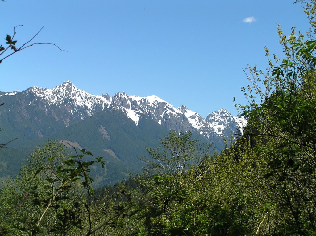
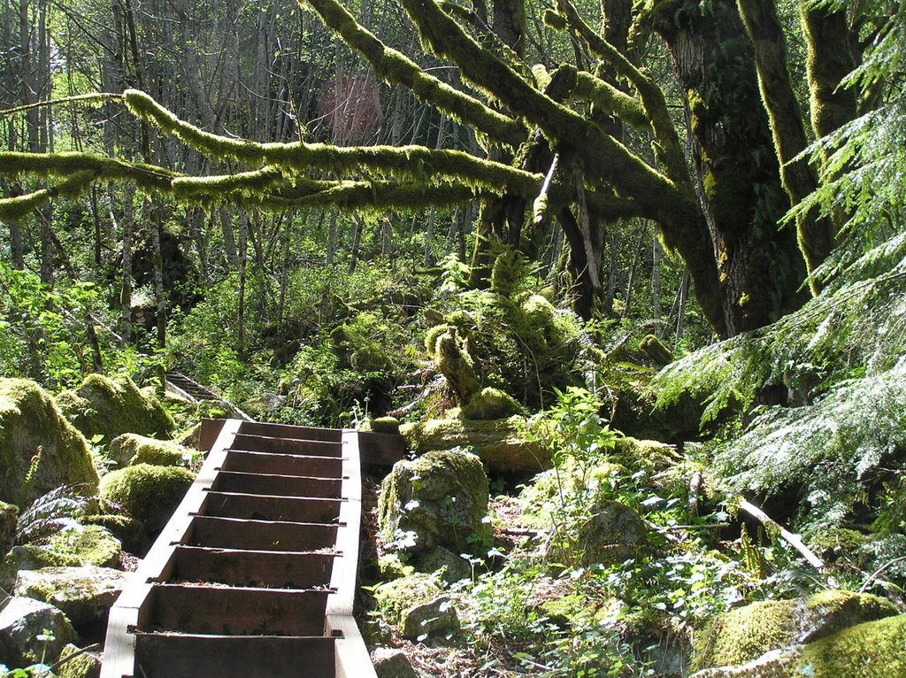
Steep it was though the trail is well maintained and wooden staircases make the steep slopes much easier. Soon you're climbing through old-growth forest with great views of Highway 2 down below and the mountains all around.

I decided to head for the Falls first and then, if I had enough time, hike toward Lake Serene as far as the daylight could take me.


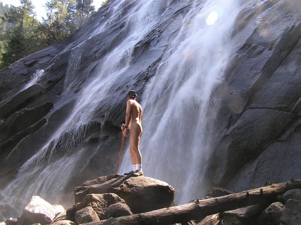
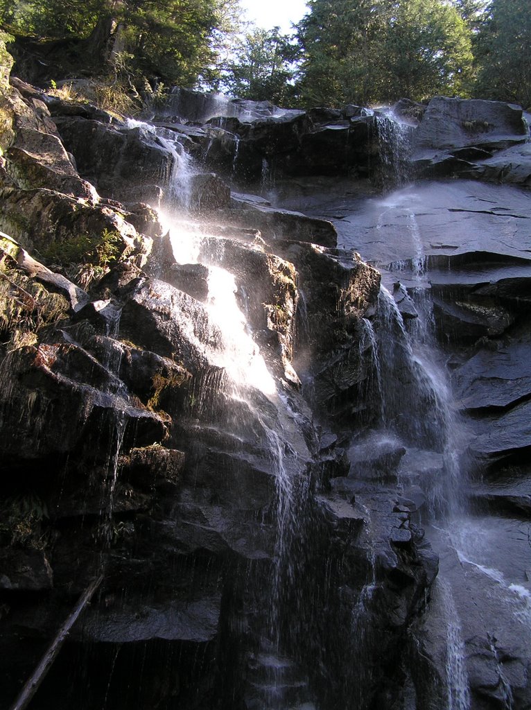
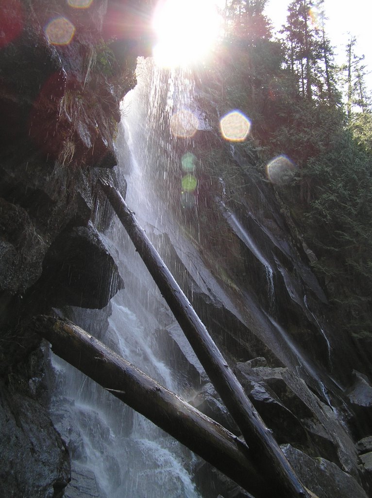
Of course, I had to climb over the protective fencing to check out the falls up close and personal . . . and catch the sunlight. These are the second from the bottom of four falls. I spent an appreciable amount of time up there exploring (and coming too uncomfortably close to slipping over the edge on wet granite). Eventually I headed back on down and turned left to check out the Lake Serene portion of the trail. I met one hiker overtaking me on his way to camping up at Lake Serene (which, by the way is still half frozen in June).


On that lower trail I got a idea of the size of the falls I was just at in the above picture. Another half mile down the trail you hear the roar of another waterfall and then all of a sudden come across it as the trail passes the base.


They are not as thundering powerful as Bridal Veil but nonetheless beautiful. My sunlight will be blocked by the nearby towering peak soon, so I start on my way back enjoying a slow amble along known paths now. Not a bad hike.

Tuesday, May 30, 2006

Beginner Nude Hiker?

Just a few simple ideas to make that first hike good:

Firstly, relax and don't worry too much. Most people you inadvertently meet on the trail are of the tolerant sort and encountering a nude hiker isn't totally unheard of. You do want to be considerate and prudent so . . .

  • Pick the lesser used trails (good resource is the Forest Service listings, link in the Sidebar)
  • Do your hiking on a weekday when trails are not as well used (if at all)
  • Hike the back Forest Service roads that do not service trailheads (again, check the maps and the Forest Service) . . . old logging roads make great nude hiking areas
  • Pick a trail that only has one trailhead versus one that has trailhead at both ends. That way you won't be surprised by someone hiking in from the other direction
  • Cars at the trailhead usually means that someone is on the trail . . . no cars and no trailhead at the other end and you can confidently hike in nude knowing that no one is on the trail ahead of you
  • Learn to open your senses and be observant. Tracks? Are they old or fresh? Spider webs across the trail? All are signs of recent activity or the lack of it.
  • Hike in the first mile clothed or ready to clothe. After the first mile you see very few hikers as most just give up. Those you might meet are often just like you or very tolerant.
Decide what you are going to do if you do encounter someone on the trail . . .
  • If your senses are open to the surroundings you should be able to hear or see someone approaching long before your nudity is apparent. Out of consideration, slip on a pair of shorts.
  • Always clothe yourself if there is a chance of encountering children on the trail. Likewise, before going through a campground on a trail, slip on some shorts.
  • Simple nudity is no illegal in National Forests in this region (Region Six, the Pacific Northwest). That does not make nudity legal, though. If you are told to clothe up by a ranger, do so. Lewd behavior is illegal and will get you cited should someone complain.
  • Simple Nudity is prohibited by rule in the National Parks except where permitted by notice (such as the pool area immediate to Olympic Hot Springs in Olympic national Park.
  • All nudity is illegal in Washington State Parks.
  • On Department of Natural Resources (DNR) lands, nudity is treated much in the same way as the National Forests.
  • On encountering someone on the trail, short up only if you can do so without looking panicky and stupid. Otherwise it's just best to grin and bare it. You'd be surprised how few people even care. Try putting your shorts on before hiking: Can you do it with a backpack on? Will they even slip over your hiking boots or are you going to end up rolling down the slope with one foot stuck in them. I've taken to putting my shorts out of reach on some of the more remote trails. On the few occasions I've encountered people, just knowing there is no way to get those shorts out of the pack and get them on, makes it easy to stand my ground and hike nude as if it were the most natural thing in the world . . . which it is. After a few times of that, being nude and staying nude becomes second nature. Encounters rarely bother me.
Take care of your skin:
  • Hiking in the mountains brings you that much closer to damaging ultraviolet rays at altitude. And there are some parts of you that have seen very little exposure to sunlight. Use sunblock, especially if you are fair-skinned and subject to sunburning. The pump-spray type of sunblock works best if you are alone and need to protect your back. Remember to re-apply it if you have been sweating a lot or have gone skinny-dipping.
  • Moisturize your skin! The environment will dry it out and make your skin vulnerable to cuts and scratches, poison oak (little in the west side of the Cascades), stinging nettles and bugs. If your skin is hydrated and in good condition it will stand up well to these assaults.
  • Do not hike at dawn or at dusk. These times are the favorite feeding times for mosquitoes and no-see-ums. DEET is the most effective insect repellent around but it is deleterious on the skin and is probably systemically poisoning us. Use DEET sparingly. Spray you pack instead and attach several repellent wipes to the pack and your hat. All biting insects are attracted to the carbon dioxide we breathe out . . . that's why they hang out around the tailpipe of a running motor.
  • Horse Flies (attack the legs) and Deer Flies (attack the head) are vicious nasty biting pests. Learn their habits and favorite areas so you can avoid them. Do not use fragarent or fruity aftershaves or frangrances as these attract insects, not to mention bears.
  • If your skin is adequately moisturized you will stand up to temperature changes better. Hiking produces a huge amount of heat energy which is dissipated easier when nude. But likewise, when you stop moving your body is still radiating that heat away into the environment. Learn your limits on exposure and the warning signs of hypothermia (too cold) or hyperthermia (too hot). Vitamin B6 and acclimization will boast your basal celluar metabolism enabling you to withstand the cold a little longer . . . most people can withstand 50F indefinitely without slipping into hypothermia . . . you are putting out enough heat to balance what is lost. B6 and acclimization can take you down into the low 40s.
  • Conversely, hyperthermia is overheating, usually excaberrated by loss of electrolytes from sweating and a thickening of the blood (heat exhaustion). Strangely, it is more a problem for nude hikers because we have more skin exposed to evaporate sweat into the air and thus we can slip into heat distress without much warning (the first warnings you will get are the cramps and general muscle weakness). Bring plenty of water with you and drink it. A sage saying goes that if you are peeing clear, you are hydrated sufficiently. If not, then you are not drinking enough water. Getting into the habit of sipping as you hike. If you are already thirsty, you are dehydrated. Carry salt tablet or a rehydration pack. If you desire salt, trust your body . . . it's asking for those electrolytes.
  • Avoid coffee and colas. I love coffee and I ignore this rule, but coffee is a diuretic . . . it makes your kidneys work overtime in pulling water from your bloodstream. Your going to piss more! Same with alcohol.
Keep a sufficient energy reserve:
  • Hiking in the mountains can use 4-6,000 calories a day. Carb load yourself the day before.
  • Avoid a large meal before or during a hike. Digestion uses up to 60% of your available energy output to digest that meal . . . energy that is not available for hiking. Stick to small snacks or high carb/high protein. Chocolate is the hikers lifesaver . . . there is a lot of energy in a simple chocolate bar.
  • Carry a couple of runner's glucose gel packs for immediate energy when needed.
  • Avoid flatulent foods such as eggs, animal fats, the cabbage family. The produce gas and sometime painful cramps or explosive decompression as you gain elevation.
Accessories:
  • Wear a hat. Make it light-colored . . . deer flies like dark colors.
  • Wear sunglasses. The sun is very bright up top . . . especially if you come onto a pristine alpine snowfield.
  • Carry an emergency poncho in a pouch. The weather turns on a dime in the mountains.
  • Wear the best pair of hiking shoes or boots that money can afford. Your feet have to get you in there and back out again. Wear two pairs of socks so that the inner pair slide against the outer pair to minimize blisters. The pairing also acts as a wick to move moisture away from your feet. Carry a spare pair of socks. Clip your toenails. If you don't and they cramp against the toe on the downslope you aren't going to want to hike too far.
  • Carry a least a few bandaids and a styptic pencil (the type shaver's use) to take care of minor scratches and cuts before the biting insects are attracted to the fresh blood. Consider at least a small first aid kit in your fanny pack or backpack
  • Let someone know where you're going and the time you're expected to check back in. If there is a chance of getting lost, carry maps and a compass . . . maybe a GPS unit. Carry your cell phone. It might work, especially on the higher ridges. Carry something that can act as a signaling mirror. Always, always, carry something reliable with which to make a fire that may save your life.
  • Have a good hiking staff or pole. Mine is a piece of deadfall I picked up year ago and I love it.
  • Bears aren't much of a problem. They're shy creatures. But I still carry bear deterrent . . . it's very effective . . . especially on the two-legged variants.
Even on a long 7-8 miler, everything you should need should fit into a fanny pack versus a backpack. The idea is to maximize your skin exposure and trudging along with a backpack is not my idea of getting sun on my back. I rarely even buckle on the fanny pack, instead, preferring to sling it over a shoulder so that I feel I'm truly hiking free and nude. Let me know if I'm missing anything . . .

Rick

Monday, May 29, 2006

We Had a Successful Clean Up Event at Scenic this Saturday

32 Wonderful souls moved mountains of trash this past Saturday at Scenic Hot Springs. The springs are getting that much closer to being re-opened legally as a nudist-friendly venue. Read the blog posting in the Scenic Hot Springs blog.

Rick

Monday, May 22, 2006

Ted passed away today

My brother-in-law passed away after a short but acute bout with cancer earlier today.

Ted's cancer had progressed from a melanoma on the neck to his lymph nodes and then on into a double-lung cancer that did not respond to agressive chemotherapy. Ted had a love of life and his rural home in the foothills of the Cascades. I remember him most for the extended hiking trips we took. He had a fasination with all things in the making of beer that were is traditional Christmas and birthday presents to everyone he knew. Ted leaves behind his wife (my sister) and his teenaged son. We will all miss him; he was very much a part of my life.

Saturday, May 13, 2006

Nude GeoCaching: Foss Moss

Foss Moss by bangedupshins (2/1.5)

N47° 39.572 W121° 17.970 (WGS84)
UTM 10T E 627680 N 5279860

Use waypoint: NWP002 User Data: Nudibility Potential Very Good

Size: Regular Hidden on 4/16/2006

In WA, USA

Difficulty: ** Terrain: *½


This is a multi - cache consisting of hiking to two locations in the nude to obtain the directions to the actual cache, located within an ammo box. The clues will take you on a hike of approx. five miles (round trip) . . . plenty of time to enjoy being clotheless. How you prove you did the search au'natural is unimportant. The whole purpose for this geocache it to enjoy doing something au'natural in a relatively nude-safe location. There are no reporting or logging requirements other than to sign the log and let me know you've found the cache.

This location is off the beaten path. The dirt road has been decommissioned and does not even show on the newer topo maps, so you should not have any problem hiking nude; I never have and I've free-hiked it dozens of times. It is one of the few locations you can walk away from the crutch of clothes and not have to worry about quickly covering up. That's how unvisited this location is . . .

Access: Take SR2 past Skykomish and the Skykomish Ranger Station. Just past the Last Chance Espresso take the right onto Foss River Road and follow it in as it become a gravel forest service road. Continue past the Tonga Ridge turnoff, the Necklace Trailhead and the Foss River Campground turnoff. You will go over two short concrete bridge. Watch your GPS for indications of the unnamed narrow gravel road to the left. The starting point is a few hundred feet up that road.


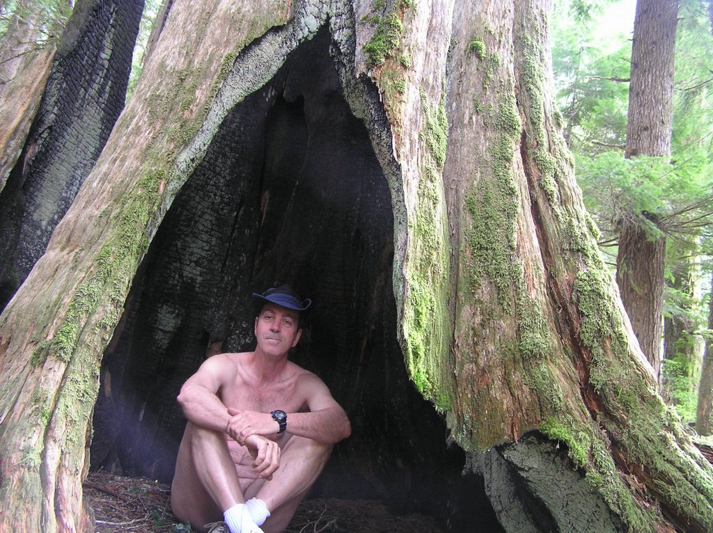
First Clue - The Posted Coordinates The dirt roadway has a short concrete spillway in case the creek overflows it's culvert. Just before this spillway is an area where you can park your vehicle. There is a campfire ring to which the coordinates point. Go off the road 50 feet or so on the downhill side in the general area of the creek. In your explorations of this area near the road and creek think of the effects of a lightening strike on a large tree and then look for the magical, human-sized opening. Once inside, check out the tunnel-like view of the sky from inside. You will see it.. Follow the simple instructions on your GPS unit that are printed on the card. Secure the clue for the next seeker.

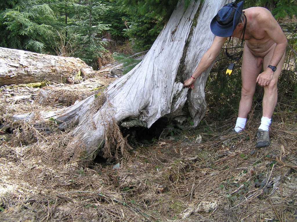
Second Clue Time for a hike up the decommissioned dirt road, setting waypoints as directed. After the second waypoint is entered, set the GPS to GOTO this waypoint and watch the distance indicator until you are approx the proscribed distance away. You should be in a turnaround clearing. At the end of the clearing on the uphill side you will see a jumble of logs, and one very obvious upright propped log (it is pretty much weathered). Again, note the instructions and rehide the clue. Now is the time to enjoy the view, catch some sun and perhaps have lunch.

The Cache Did you see it and wonder on your way up? The cache is approx 550 feet due south along the obvious wide path but you don't need a GPS unit to find it now. The cache is concealed behind an obstruction right next to the overgrown trail within fifty feet of the far end of the bridge.

Note: Although the instructions indicate you will enter the brush at points, this is very open terrain and you should have no need for protective clothing other than a good pair of hiking shoes and some light-weight utility gloves. If you have parked just short of the spillway you are already out of sight of the main road and near your first clue. You can strip right at the car and leave your clothes there for this search. All you need is your GPS unit, a compass and a good eye for distance; plus a water bottle and perhaps a lunch to enjoy in one of the clear-cut, sunny areas you will cross. You may need a small flashlight to read the first clue and a small memo pad and pen is handy to write down directions.

Safety: This cache is located in National Forest and in a relatively unvisited area. Take normal precautions and be aware of your surroundings. Black bears are known to forage in the Foss River valley down below. They are shy creatures and avoid humans but be aware of the time of year and the potential for bears foraging berries along the side of the abandoned road.

A bigger problem are the deer flies that hatch in early August in waterbound areas at the higher elevations . . . particularly Evans Lake. Be prepared to deal with DEET. Also consider sun exposure at the higher points.

You cannot get lost on this search; merely follow the road track back to your car. Do not attempt to drive your car past the short spillway. The road quickly narrows and presents few turnarounds unless you have 4WD and adequate clearance.

Additional Hints Hints


Current at 4/16/2006


Decoded Hints

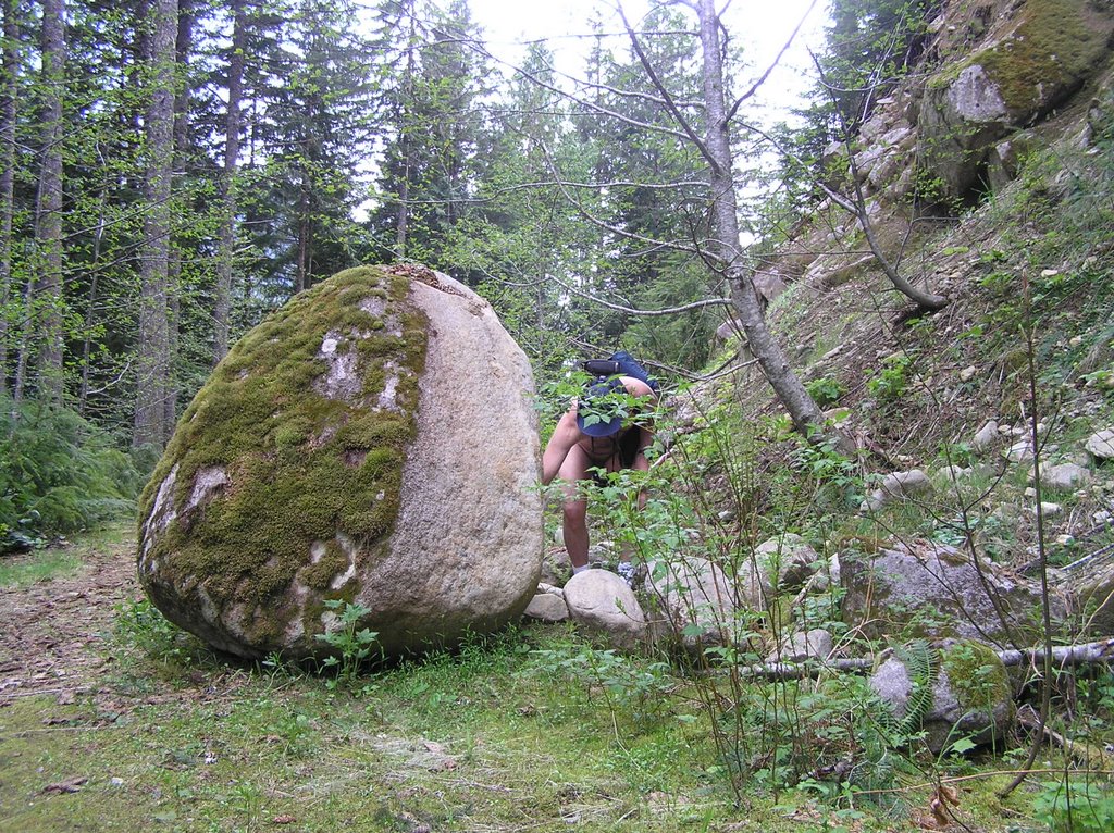
They say a rolling stone gathers no moss. But this large boulder has been sitting beside the trail long enough to become Foss Moss!

Spoiler #1: The location of clue #1 can be seen in pic # 1

Spolier #2: The hiding location of the 2nd clue is in pic # 2

Spoiler #3: The cache location is obvious in pic # 3 . . . if you can figure out where the picture was taken.

Friday, May 5, 2006

Silver Creek-Mineral City: Grin and Bare It


I gave myself a present today . . . I took some time off for myself, by myself. I did a hike I'd always wanted to do but lacked the time. With another beautiful, sunny day and things stable with Ted it was time to stretch the legs.


The trail up Silver Creek to Mineral City is not well-marked on most maps, and is certainly not signed nor listed with the Forest Service. You get to the starting point a little more than nine miles (9.3) down the Index-Galena Road, zeroing your odometer at the Highway 2 turnoff for Index. Immediately after crossing the wood-deck bridge over Howard Creek you take a left to cross the bridge over the North Fork of the Skykomish River. The road immediately become dirt and forks straight and right a couple of hundred feet on the other side. Straight heads up Salmon Creek and right slips around the bulge of the mountainside toward Silver Creek. I took the Silver Creek right. It is drivable (in my Civic) about a mile up. I could have parked at the road fork with easy access and so on but I didn't trust leaving my car there. From my previous forays into this area I knew there were a number of pullouts to safely park a vehicle out of prying eyes and idle hands. I also thought the road obscure enough that the car would be safe for an extended period.

The one time I hiked a portion of this road, it deterioated quickly into a jeep trail. I'd only scouted about a mile in and never saw anybody. Some 4WD tracks to a clearing that is obviously used for the gun aficionados but then the road gets even rougher. Beyond the few rustic cabins down below on the west side of the river that need access, this road seems to have been decommissioned and left to revert beyond the one mile point. The 1972 topos show the road continuing around the bulge of the mountainside and up the south side of Silver Creek in a northerly direction. With the road falling apart so much, I wondered how accurate those maps were.

I parked my car as far in as I dared. All the property along the river is private and so signed. There are a few points where signage is absent and I trekked down for a great view of the river. Then it was back to the task at hand . . . Mineral City.

The Galena claim (which lies dormant the best I can figure out) is a followup to the copper, silver and gold finds in the regions to the north . . . the most well-known, the Monte Cristo claim. Mineral City is less well-known and lays about four miles up the Silver Creek valley near the base of the 8,000 ft Silvertip Peak. On the other side of Silvertip lays the valley of Monte Cristo. A trail runs through Poodle Dog Pass between the two sites (an adventure for a later trip). Other than way the topos told me, I knew nothing about the terrain or conditions . . . or even the present existence of Mineral City. I just knew that I needed a good nude hike . . . really the only excuse I ever need.

A four mile hike in and four miles back is right at the verge of me bringing a backpack in case it takes longer. I decided to travel really light with just my thermos (did I mention I like my coffee), and a fanny bag. I undressed right at the car, confident that I had the road to myself. Normally I would carry a pair of shorts in case I needed to cover up but that seemed superfluous. I was not going to meet anyone going in or I would have seen another vehicle parked. By the time I would be coming out it'd be too late for newcomers to be inbound. I was wrong on the last count. I left the shorts and teeshirt on the front seat of my car, locked it, and started the easy hike up the still drivable road.

The full sun to my back felt good. I felt a little nervous being in full view on a straight road . . . thinking, that I really don't know where this road leads and who might have a reason to be driving up it (or back down). Then there were the deep-tread tire marks from a jeep or similar vehicle that were made within the last day or so. Instead of worrying about such intangibles I immersed myself in the surroundings and the ever-present noise of the rapids in the river way off to the right down the steep slopes. Soon the road became too torn up for anything but a jeep to negotiate . . . which the tracks did. But they were from a day or so before. I relaxed and let myself enjoy the glorious feeling of walking nude in the sun and trees and breezes so gentle on the skin.

The grade is gentle (as the entire hike was to be with a few minor hurtles). About a mile and a half in the road Y's with one fork heading uphill to the left and another straight. This didn't show on the map. A left would be required to turn into the valley of Silver Creek but instinct told me not the trust the left fork. I tried straight ahead. Within a hundred feet the road ended and became a footpath onto a huge pile of talus and skree. The path across was obvious and seemingly well-maintained.

Strangely, the open road behind me (as torn-up as it was) had made me edgy. The moment it became a trail I was in my environment and could really relax. The sun was bright and full on the talus and Silver Creek was roaring far below over thunderous falls. I took my first break here, kinda reluctant to re-enter the stunted tree line and give up the full sun.

The path across the skree is narrow . . . no more than 18 inches. The skree is also very loose and one misstep or loss of balance meant a several hundred foot fall down an extremely steep slope of razor-sharp rock to the raging creek below. I made sure of my footing. Still, I was surprised that the obvious footpath was in such good condition after the winter. For an obscure trail, someone was maintaining it.

The trail picks up an easy level path on the other side. This was once a mining or logging road as was obvious from the reclaimed width. The evidence of maintenance is all around with machete-work on fresh-cut saplings to keep the trail open. On the downside of the slope there are numerous terrain-benches perfectly suited for camping, which the campfire rings attested to . . . though not in use today. Have I missed a perfect gem of a trail?

I come across my first mine shaft opening in a solid pluton of iron-oxide stained rock. It is right there beside the trail. I explore the entrance briefly but there is no way you would catch me going inside. Still, the mine shaft was unexpected and not on the map nor the mines database I'd consulted earlier. There would be a few more. That it was once a narrow road is obvious at this point. What is more interesting is the roar of rapids and falls from the creek (river?) below, whicj have been accompanying me up.

I reach Quartz Creek (which had confused me when I researched the route because there is another Quartz Creek that is a favorite hike of mine; they are unrelated). This is the one spot on the map were the trail stops and then picks up a short distance later. Now I saw the reason. There was a huge chasm seventy feet across and a like distance down where the bench had been washed away. If there was ever a bridge across this it had long ago disappeared. How do I get across? The sides were sheer and unstable. A few moments later I spotted the ladder down to the bottom. It took some reluctance and careful testing before I trusted my naked self to putting weight on the rungs. The ladder was almost vertical and at an unnatural sideways cant. Quartz Creek rushed by and had to be forded at the bottom . . . and then it was pull myself up the steep dirt bank on the other side by a brand new climbing rope that someone had thoughtfully left there. Brand new . . . no dirt or weathering. But why? Who was maintaining this trail? This was not Forest Service work.

The next few side creeks and gulches have vehicle-width wood-plank bridges across them. All of them are in disrepair with rotten planks and in one case an entire longitudinal support dropped one hundred feet below into a raging gorge.

I step carefully, prodding the wood deck ahead with my staff, listening for the dull thud of wood wanting to give out. I don't think these bridges will last out more than another season or two. For now, they hold my weight, which is inconsequential considering the vehicles these bridges must have been constructed for. I feel confident enough to enjoy the waterfalls coming down off the Crested Buttes far above . . . or the great views of Silver Creek raging far below.


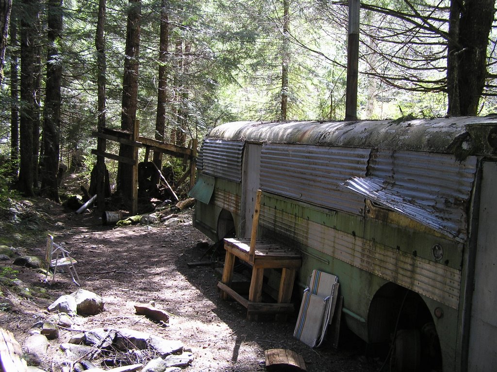
Back on the level trail after another section of talus and skree I spot something out of character in the treeline ahead. Shape and color, it looks artificial, and as I get closer I realize it is an old bus. I slow. Is someone living out here on Forest Service land? Squatters? Drug lab. As I get closer it looks disused so I approach it. Seems sealed up. No tires; windows sealed over with metal . . . almost looks fortified. One section of metal has been pried up . . . someone taking a look-see. I take a look as well. Hasn't been taken care of . . . spider webs and such inside. There are a couple of lawn chair stacked up outside that do seem relatively new . . . but no one is around. I continue on my way.

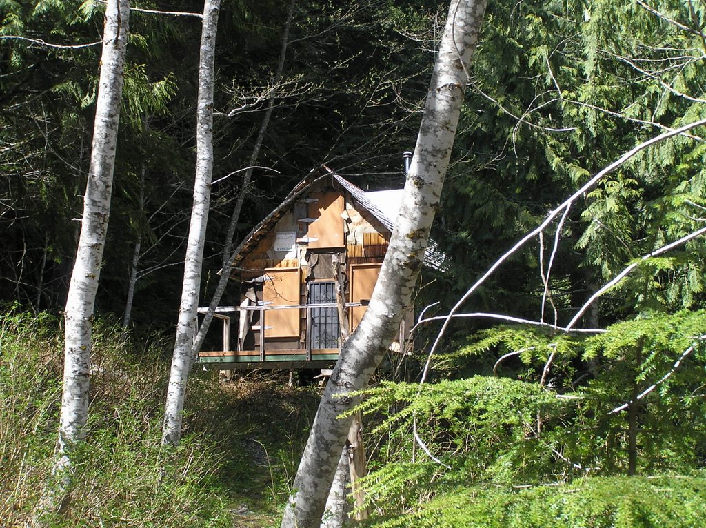
The cabin takes me by surprise. It is right off the trail in a flat area with No Trespassing side posted. Like the bus, the cabin is all boarded up but looks in good shape. The metal chimney sticking out of the roof is new. Still, no one is around and I'm pretty sure that I am on National Forest property. The 'No trespass' is not on the trail so I continue past.

The trail gets wet now. I pass another old mine opening in the solid rock next to the trail. Trail maintenance seems to have stopped around here as the new growth is encroaching. Fallen trees make for climbing over or detouring as I start to enter the residual snow at this elevation . . . just patches of a couple of inches . . . more in the flat areas to the right. Near the head of the valley, my GPS said 7/10s of a mile. I look at my watch. I can't afford the extra half hour . . . not without being able to see an obvious target through the young trees obscuring the head of the valley.


I decide against trying because I have to be back in Carnation by seven. Reluctantly I take a quick break and then head back down.

I met my first hiker soon after passing the bus . . . inbound for camping. Took me completely by surprise, but I didn't have any shorts to cover up if I wanted to. Grin and bare it; he was totally non-plussed and we exchanged ideas on how much further he had to go and the bus and cabin on his way (it was his first hike in as well). Not a bad encounter at all. I hiked on. I realized as I hiked that the encounter had been so easy because without shorts there was nothing to panic over . . . nothing to hurried grab and try to slip on. I may not go sans backup shorts on all nude hikes but today, being without that crutch made everything else all the much sweeter

It wasn't until I was well on the gravel road within a mile of my car that I had my second encounter . . . a couple with their dog. Again, what can I do but be natural . . . I smiled, petted the dog and we chatted about their destination . . . which wasn't far. It was as if I wasn't naked at all. Actually made me feel real good inside. The rest of the hike back to my car was uneventful, though I did find myself slowing down as I got closer . . . to prolong the experience. What a wonderful day!

Friday, April 28, 2006

Hiking as a Catharsis

I received an email today from Chris in Vancouver, BC. He wished me and my family well and expressed hope that I would get up hiking again soon. I thanked him and noted that I had gotten a few hike in but that I just had no desire or energy to post about them in the blog.

Then I stopped and re-read just what I had written . . . flashing back to re-experience those hikes in my mind. What did they do for me? Was there anything special about them? And yes, there was. I hiked because I needed the release from pent-up stress.

Having a family member in a terminal cancer condition tears you apart. There are a lot of emotional issues to deal with besides the financial ones; the disruption of life. My brother-in-law is very important to me but the wear and tear-toll subtlely worms it way into my body and spirit as well.

I've done two hikes since the last posting . . . both of them to Scenic Hot Springs at the behest of the owner. They weren't exactly recreational hikes in that he'd asked me to check out conditions of the record snowpack. So both of them started out with a sour mood . . . heck, I really din't feel like trudging through all that four-foot deep snow just to see if the springs are still running. Too much like work! And what if . . . ? Cell phones worked only sporatically out there. So the trek up began with certain feelings of guilt about being away.

Snow has such a cleansing purity about it. I'm out of shape, without showshoes, and postholing frequently in three to four feet of untrampled snow on the steep slopes. But there is the magical quality that comes with the second wind and a beautiful sunny day at a cleared section of the BPA road halfway up. I really have this entire mountain to myself.

I sit down of a cold granite boulder the size of a car and take it all in. The quiet, the cleanliness, the spiritual bright of sunlight on virgin snow. I slowly undress and stuff all the inconsequential clothing into my backpack . . . from waterproof rainpants and jacket to thermal underwear. My skin screams for sunlight and absoulutely sucks it into every pore as I stand there naked and exposed in only my hiking boots and floppy blue hat. It feels so freeing. The pack is reslung and clipped . . . survival lies back there if this is a stupid idea. I have no idea how much snow lies ahead on the trail but I'm willing to find out. The trailhead entrance is beckoning me in like the Sirens of Lorelei.

Negotiating a path above Rock Alley

The snow is much deeper on the actual trail off the BPA road, but beautifully carved into mini Grand Canyons to bare warmed hardpan where the hot spring creeks cross the trail. I encounter my first major obstacle about halfway up in a place we affectionatly call 'Rock Alley' a narrow stretch of trail deeply and severely etched by years of runoff and lined with hundreds of granitic boulders. In the narrow vee of Rock Alley all I can see is a smoothed and even eight-foot deep plug of white with a hard-won trail bravely forced through by some other intrepid hot spring seeker.

It is more than I can accomplish today. I have no desire to climb naked up those eight foot drifts of unstable snow. My body is warm and comfortable. I am content just to explore around the base and enjoy the solitude. Eventually I head back down to the thawed area near Meadows Springs and set the coat from inside the pack down on a large piece of bedrock to sit, eat the sandwich I brought along and quietly sip coffee from the thermos. It is some time before I start the slow hike back down hill; reluctant and delaying the moment I must unsling the pack once again and seek 'civilization' inside. I wait until I am at the gate . . . almost in view of busy Highway 2 before I redress for the trek down the highway to where I parked.


My second hike came but a few days after the first . . . again a snow conditions check. This time I make it past the plug at Rock Alley, enduring the shower of loose snow as I scramble naked atop and on up. A smile? Yes. I'd feared the snow earlier because of it's depth. Now I was above it and trudging on up toward the main springs.

Enjoying the view on a knoll high on the second bypass trail

Remarkably, the pool is a toasty 100F and the springs running at 111F and 105F, respectiuvely. I had expected cooler but I have the place to myself and a wonderful soak to relax myself.

The hike back down the mountain was a slow amble to enjoy the rest of the sunny afternoon. Back at the car I change out of the clothes I'd pulled on for the quarter-mile side-of-the-highway section. The heater gives warmth and laziness. I sit there feeling good wearing nothing but a long teeshirt. It wasn't until I stopped at the QFC parking lot 70 miles later in Seattle that I realized that I had driven all that way naked from the waist down. That's how relaxed I'd been feeling. Fortunately, little would have been seen since the teeshirt was a longish affair. But it did bring a rare smile to my face as I pulled on some shorts to do some dinner shopping. A day of smiles is good for the soul.

Wednesday, March 15, 2006

I will be taking a sabbatical for a couple of months

When I was eleven years old we, as a family, embarked on the trip of a lifetime from the cool climes of Canada on a roadtrip to exotic sunny southern Florida and Miami. Us paleskinned Canucks sunburned a bright scarlet red of course but I still remember vividly the one thing that cut our trip short and sent us driving the old highways back to Toronto (this was before the great Interstate highways we have now). The one thing that perplexed the doctors and sent us all into a panic was a case of sun-poisoning on my younger brother's cheek.

Decades later, that one freakish happenstance has come back to haunt the family time again with skin cancers common amongst us. My father is Greek and I inherited his olive skin tone and resistance to the sun in a similar way. So did the next sister down from me. However, the rest of my brothers and sisters have all have various pre-cancerous and cancerous lesion removed from their skin because they apparently inherited my mother's Anglo-Gaelic fair-skin and red hair.

So . . . now we have a much more serious case of skin cancer in our family and I will be taking the time to provide aftercare at the expense of keeping this site updated. It was an easy decision to make; a no brainer. For me, family is everything.

But for you, my readers, I just wanted to let you know that I have not given up or grown jaded. I will be back and posting when I can.

Please, don't overdo it in the sun. Use sunblock.

Til I return, stay safe, enjoy the emerging springtime and enjoy every moment of it. Life is precious.

Rick

Thursday, March 9, 2006

Safety in Bear and Cougar Country

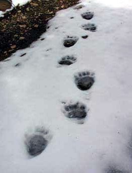
Black Bear tracks from last spring's late snow melt on the Tonga Ridge

A recent article in the Seattle PI on winter getaway hikes remarked on the movement of cougars down from the higher elevations of the Cascades to lower altitudes in search of food. On a recent snow hike of mine I was somewhat surprised to find bear tracks in the snow this early in the season. I think a reminder of bear (and cougar) protocol is in order if you plan on going hiking or camping. Rick


BE 'BEAR AWARE'
(adapted from the BC Government Chilliwack Forest Service Recreation Brochure, with additonal material, including my own in red)

Bears usually avoid people, but they can be attracted to human food and garbage. For your own safety, take the following precautions: •Avoid all contact with bears - never feed or approach bears or other animals. Don’t try to get close for that perfect photo!

•Dogs can annoy bears and bring them back to their owners. It’s best to leave your dog at home or keep it on a leash.

Be Camper Smart:
  • •Never store food in tents.
  • •Store ALL food (including pet food and game meat) in the trunk of your vehicle, or put it in a sealed container and hang it from a branch at least 12 feet above the ground and more than a yard from the tree trunk.
  • •Sleep at least 150 feet from the area where you store and cook food. Pitch your tent away from dense bush, lake shores, stream banks and animal trails.
  • •Keep clothes and gear free of food odours, and dispose of dishwater at least 300 feet from your campsite.
  • Do not cook strong-smelling or greasy foods. Burn out tin cans after a meal if you have a fire.
  • •Keep your campsite clean. Put all garbage in bearproof containers or pack it out. Never bury garbage - bears can dig it up.
  • Don’t use or pack strong-smelling or herbal scented perfumes, deodorants, shampoos, etc.
  • •For the ladies, use extra caution if you are menstruating and choose to camp in bear country.

Don’t Surprise Bears:
  • •Carry a bell, sing, talk or make noise along a trail to avoid startling bears.
  • Never hike alone, or after dark.
  • •Never come between a female bear and her cubs.
  • •Stay clear of occupied bear habitat - berry patches, avalanche chutes or streams with spawning salmon. Leave an area the way you came if you see fresh signs of bears such as tracks, droppings or diggings.
  • •Be wary of hiking in high winds. A bear — or a cougar — may not be able to pick up your scent and have time to move off before you come across it.

Close Encounters:
  • •Never run from bears.
  • •BE HUMAN. Never imitate a bear, or make “bear” noises. Back up slowly and speak in a loud, low voice while waving your arms. Avoid direct eye contact. Stay calm.
  • •Return to your vehicle or climb a tree as high as you can.
  • •Drop something, such as your backpack, to distract the bear in case it decides to charge. Almost all charges are “bluff charges.”

If you are attacked: how you respond should depend on the species of bear and the circumstances. Black bears and grizzlies behave differently and may have different motives.

Aggressive bears are usually defending their territory, their food or their young. Predatory bears, on the other hand, are looking for food.
  • Grizzly Bears - it is best to play dead. Struggling will encourage attack. Drop, curl your knees up to your chest and place your hands behind your neck.
  • Black Bears (common in the Cascades) - Fight Back! Use everything you’ve got - sticks, rocks, hands and feet. With predatory black bears your best chance is to fight them off and chase them away.
Carry Protection: •In case of meeting an aggressive bear, carry noisemakers and pepper-spray or bear-spray (an effective deterrent).

COUGAR SAFETY
  • Cougars rarely attack people; in fact, they usually avoid human contact. However cougar attacks do occur. You should keep a close eye on small children and watch your pets — they are both easy prey for cougars.
  • NEVER LET SMALL CHILDREN VENTURE ALONE INTO BUSH AREAS WHERE COUGARS ARE KNOWN TO BE PRESENT.
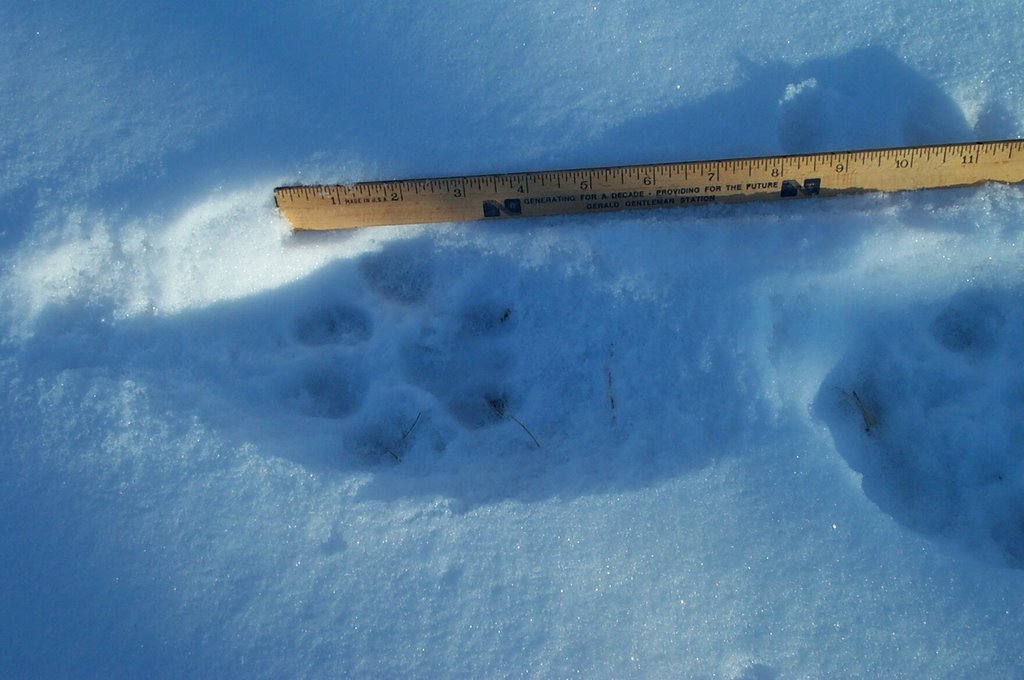
Cougar tracks near the end of the BPA maintenance road below Scenic Hot Springs at the 3,000 ft elevation. This is a known traverse area for deer. There is a known cougar den in the rockslide area to the east of the springs around 4,200 ft. Cougar are nocturnal creatures, shy and avoiding humans. They hunt generally close to dawn or dusk. The tri-lobe of the footpad is a giveaway of cougar tracks; dogs tracks, while similar, lack the three lobes at the back.

If attacked by a cougar:
  • Fight back using sticks, stones, hands and feet! Cougars have been driven away by people fighting back with rocks, sticks, binoculars and even their bare hands.
  • Don'’t “play dead” in case of cougar attack.
  • Do not crouch or bend over: In Nepal, a researcher studying tigers and leopards watched the big cats kill cattle and domestic water buffalo while ignoring humans standing nearby. He surmised that a human standing up is just not the right shape for a cat's prey. On the other hand, a person squatting or bending over looks a lot like a four-legged prey animal.
  • Do not run from a lion: Running may stimulate a mountain lion's instinct to chase. Instead, stand and face the animal. Make eye contact. If you have small children with you, pick them up if possible so they don't panic and run. Although it may be awkward, pick them up without bending over or turning away from the mountain lion.
  • Do all you can to appear larger: Raise your arms. Open your jacket if you are wearing one or lift you backpack over your head. Again, pick up small children. If the animal does not flee and shows signs of aggression (crouching with ears back, teeth bared, hissing, tail twitching and hind feet pumping in preparation to jump) be more assertive. Throw stones, branches, or whatever you can reach without crouching or turning your back. Wave your arms slowly and speak firmly in a loud voice. The idea is to convince the mountain lion that you are not prey and that you may be a danger to it.

Related Posts with Thumbnails