Thursday, June 30, 2005

Fisher Creek-Deception Valley Nude Hike

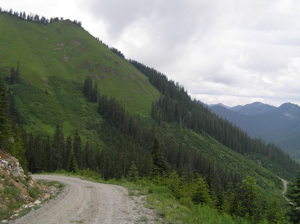
Overlooking the Deception Creek Valley
from the east side of Mount Sawyer


Just got back a few hours ago and I'm happy but tired. So this description of my hike will have to wait for a couple of hours until I refresh and get something to eat.


Well, it's been more than a couple of hours . . . actually the next day as I got involved in naturist forum exchanges about the future of nudism that have me a little hot under the collar. But I promised myself to note down my nude experiences just in case someone else would take benefit from them and also get out and enjoy this wonderful lifestyle. So my report of Fisher Creek . . .

This is the route that intrigued me the last time I was exploring up in the Tonga Ridge area . . . the back road that connects to the end of the Tonga Ridge Trail and a spur of the Decption Creek Trail. The FS road end a few hundred feet further down from these trail junctions at a blocked wooden bridge over Fisher Creek. The last time I was up there, I wondered just where the road went after it crossed the creek because obviously, if it is physically blocked from vehicular traffic then it would make great nude hiking territory beyond.

There is a huge moat of dirt and a deep, impassable ditch
in front of this bridge. Cars can go no further so off it was hiking.

I parked and since I'd driven the entire FS road nude I was ready for the hike. Even so, testing the bridge carefully with my walking stick just in case the warning sign that said "Transportation Neatwork abandoned because of drainage stability" meant the bridge might collapsed on me. It didn't . . . and I found out later that is was extremely stout construction underneath. I headed off to explore the disued dirt road ahead. Where it would take me I had no idea but that's have the fun of hiking, isn't it. Besides, it is pleasant to be able to hike without any thoughts that you might encounter someone else. This road was off the beaten track and I certainly wouldn't be surprised by any cars, would I. I liked that and just strolled slowly, enjoying the sun on me.

Road scars heal slowly. The topo maps I checked showed that this road didn't go far and those topos were dated years in the past. So I assumed the road had been abandoned a long time ago and that the topos only reflected the ending at the bridge. As far as I knew the road could indeed go somewhere and the scars of past tire compactation evidence of slow revertion.


The vegetation is retaking the road but how long will the tire ruts resist?
More importantly, how much more idylic can it get but to stroll naked down this verdant land?


Quiet, and peaceful and I feel luxurious soaking it all in. Unfortunately, those maps were correct. The road ends a couple of hundred feet further on in what looks like and ancient landlside tha once took out the remainder of this road but is now claimed completely in thick, impassable brush. I took in the signs of a few old fire rings . . . deadend camping sites. Then turned around to head back. I could have been disappointed, but I couldn't be . . . it was worth even the little walk. There was still a brindge and a creek to investigate. Still, I dawdled and took my time leaving this little secluded deadend.

Fisher Creek is not as lively as some of the others in this area like Deception but that is to be expected this close to it's headwaters. Still, the cold water does so pretty cascades over the multi-colored rocks

I have a penchance for creeks and love to get up close to them. It wasn't easy as there was no easy way down to the banks except the scrambled down through thick brambles and blackberry thorns. Scratched myself up a little before carefully stepping out onto a slippery granite boulder in the swift water.

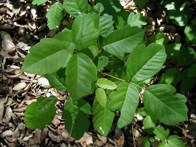
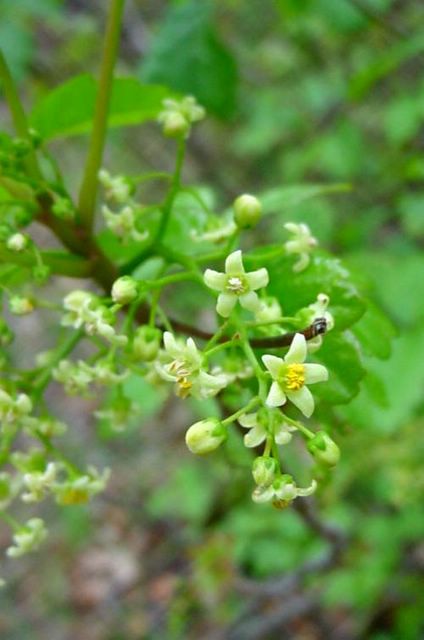
The Tonga Ridge geology is made up of a different batholith than the more common stratas of Deception and Surprise valleys. There is more oxidized iron and other mineral content in the granite whereas to the east just over the Straight Creek faultline the granite is chaulier grey and higher in quartzite. The minerals make for a lot of color in the boulders within the creek and I only wish that I'd had my rock hammer with me to collect some samples.


Off I go from boulder to boulder to explore the creek


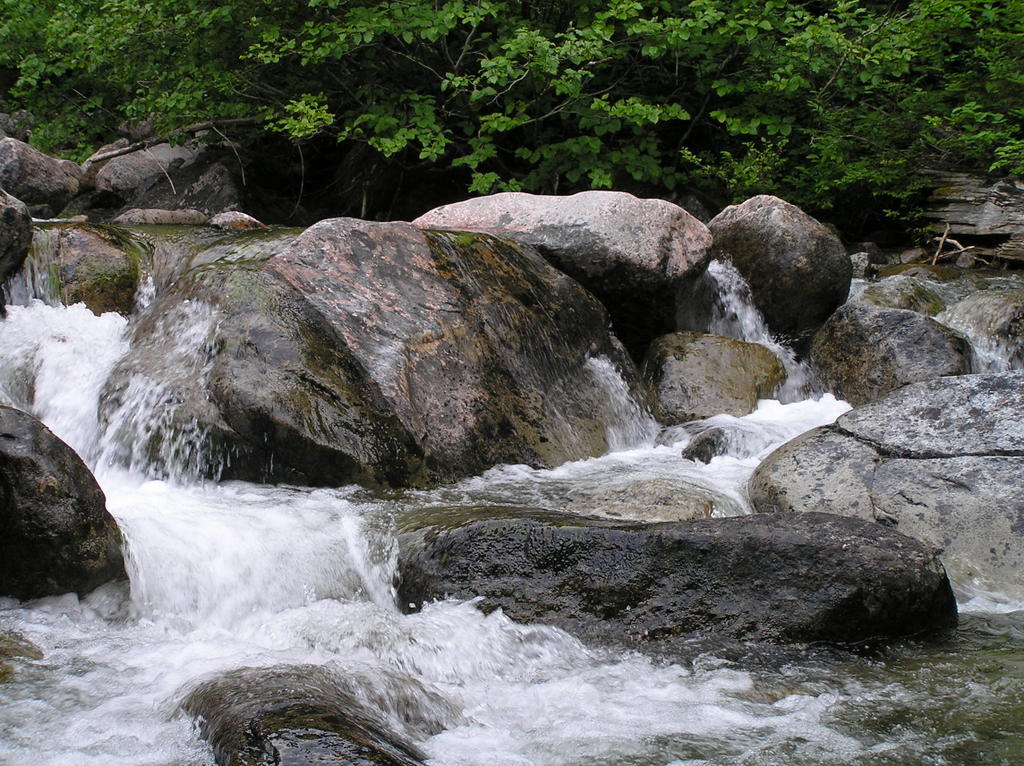
You get some idea of the different minerals in these boulders when looking up close.

I spent the better part of an hour exploring the creek and even attempting to work my way upslope in hopes of finding an easier route to Fisher lake than the one off Tonga Ridge I found last year.

I got quite wet in the process but fortunately I'd left the backpack in a safe location while I played in the creek. Again . . . it was fun . . . and I am careful.


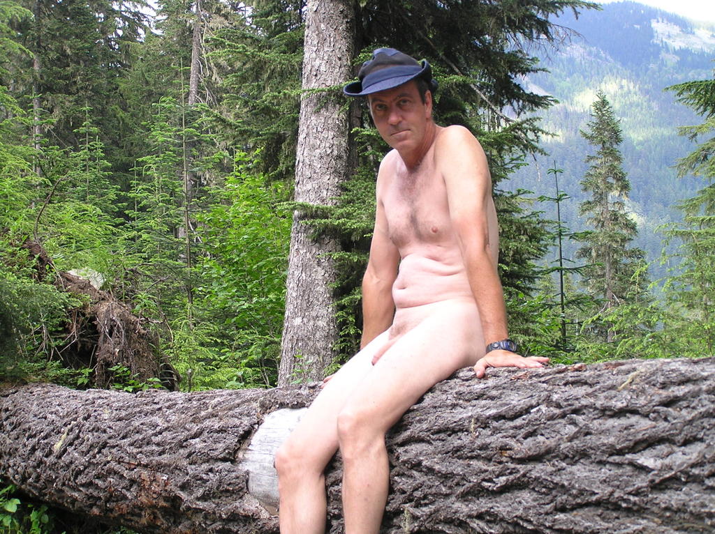
Lots of places to find a place to sit and enjoy the sun

Every nudist does it. You just cannot bring yourself to end the day and get dressed. I waffled and delayed. As the sun worked it's way toward the ridge above I found a log near my car that was still out of shadow. Precious sunlight.

The drive back takes almost an hour . . . maybe a little more. Even though there were several vehicles at the trail juncture a quarter mile up, I drove nude and purposefully left my clothes out of easy reach. If anyone was there, they'd just see me and that's that. I was going to enjoy my nudity for as long as I could. I waved at a party just getting in. I doubt they noticed . . . they looked bushed. As the road weaved up and around the northern face of Deception and Mt Sawyer the sun blared fully into the car and I made numerous stops to get out and enjoy a few more minutes of it on my skin.

I don't know what it is. Am I becoming addicted to sunlight?


Driving back down with clothes out of reach

Monday, June 27, 2005

Rooster Rock Nude Beach Under Water (snowmelt)

The sign at the entrance to the Clothing Optional Area of Rooster Rock State park on the Columbia River east of Portland MSN MapPoint here

Well, I've always enjoy a good nude rain hike so I don't suppose the fact that it was raining should take away from a visit to Rooster Rock.

That, and the fact that the mighty Columbia River is running a mite high? LOL . . . thar ain't no beach exposed at all. Got to the end of Buffalo Trail . . . the one from the stairs . . . wading through knee-deep, mucky water most of the way and was rewarded with a mere foot or two of wet sand that WASN'T under water. Hmmm . . . tides? Swollen river? Just that time of year?

I've just been educated by someone who knows . . . it's snow melt and the river is at it's highest in June and will have receded enough for some great sunning by August.

I remember the flatness of the beach from last year and wondered if it were possible to make it out to Sand Island (those two little islands in the distance) but I must have hit one of those depressions I remember cause when the water got up to my chest and I didn't seem close enough, I gave up. The water isn't exactly warm enough yet for that kind of exploring.

All the area you see under water on out to Sand Island is normally exposed, flat sand


Exploring, I did and it wasn't pleasant. Pervs all over the place towards the back trails . . . gave me the willies (no insult meant to the Willementans).

The newly installed and dedicated bench just down from the entrance. A place to change before you have to head up for the car.

The staff of the park are GREAT! Spent some time chatting with them and they are so friendly with great, positive attitudes. During my walk-about in the back area I noticed all the beer cans and bottles tossed into the bushes. I'm going to try and make this next beach cleanup. Hopefully . . . the river and weather will relent and gives us back the beach by then.

Friday, June 24, 2005

Photo: Lower Scenic Falls, enjoying the sun

Photo: Lower Scenic Falls, enjoying the sun Posted by Hello


The Scenic Falls area is becoming one of my favorites areas for a quick nude hike. The falls are close to the trailhead . . . a matter of a ten minute easy stroll from where the car is parked and on the four visits I've made this hiking season I gave yet to see anybody in the area.

Where you see me sitting, enjoying the sun, I'm overlooking the glory of the cascading water and the roar of it's 100-150 foot drop. Right in front of me! And yet no body seems to ever come this way! If I feel the need to stretch my legs I can either go down to the creek bed and be reckless (in the nude of course), or I can set off over probably 80 acres of open woodland . . . all without taking a stitch of clothing with me but the shoes and my hat. What freedom that is to be able to walk around totally naked and not have to bother carrying a pair of shorts to put on or deal with a backpack.

Wednesday, June 22, 2005

Photo: Me at LARC Last Year

Was checking out the LARC website, getting ready for enjoying their great sunning lawn when I came across this picture of me taken last year at LARC during the 2004 Buff n Shine Auto Show Open House. I.of course, just enjoyed the sun and one of the new (at the time) Dune prequels. Didn't even realize my pictures had ever made it to the website. Posted by Hello


LARC is one of my favorites places to go and relax in total peace of mind. The grounds are great, the folk friendly and one of the best sunning lawns I have ever seen anywhere.

You owe it to yourself to check this place out . . . the Lake McMurray exit on I-5 and along State 9 . . . Mapquest directions here.

Nude Hike Possibilities: Captain's Point

3 miles one-way, moderate gravel road, remote and in full morning to early afternoon sun. Take water, binocs or camera and little else. This is an easy nude hike. Topo here

Looking north towards Captain's Point Posted by Hello


Captain's Point is at the end of a seldom-used looging road above the Marten's Creek Valley beyond the Iron Goat Trailhead. The logging road is approx 3 miles one way with moderate slope. The road for the most part hug the east slope on the way up . . . making this an ideal early morning hike to take advantage of the sun. All the way you are presented with open vistas of the valley below and when you reach the end of the road at Captain's Point you can look out over the Skykomish Valley way below and spectacular Mt. Fernow to the southwest.

Birds abound, including grouse. Early on, there are opportunities to check out old construction equipment still on the road . . . including a crane perched crazily on the road.


The road is sometimes gated . . . and sometimes that gate is left wide open with seemingly abandon. The last time I hiked this road, we were startled by a beat-up car heading down . . . nothing official, I'm assuming someone up there exploring. For the most part, this area is seldom visited. On subsequent hikes I haven't seen any indication of activity. This makes this gravel road a great place for a nude hike with plenty of sight distance to cover up if wanted. You won't be surprised on this route!

To get there, take the turnoff on Highway 2 to the Old Cascade Highway (FS #67, N47 43' 5.81" W121 13' 53.24") and continue up 2.3 miles to FS #6710 (N47 43' 11.31" W121 11' 10.61"). Continue up this FS Road, avoiding the potholes in the lower section, for approx 1.4 miles to the Iron Goat Trailhead (N47 43' 46.93" W121 12' 24.27"). Take a toilet break here if necessary.


FS #6710 continues past the trailhead. Continue up another 2 miles to a junction or Y split in the road (N47 44' 52.35" W121 10' 52.89"). You will just be able to see a one lane concrete bridge over the stream to the right. This is the fork you need to take. Continue for anothe 1/4 mile past the bridge and park to the side where another logging road T's.

Now is the time to get naked but do it inside you car and apply bug spray now because this close to Kelly Creek the biting gnats swarm for warm bodies. Once on the road this is no longer a problem. The hike is straight ahead with 7 road switchbacks amid spectacular views. Enjoy.

Fremont Solstice Parade, Saturday, June 18, 2005


c Alan Berner / The Seattle Times Posted by Hello


The description that went along with this picture in the Seattle Times went "Nudity has become so old hat at the festival that a woman wearing just a purse and shoes hardly draws a glance."

Mmmmmm . . . is Seattle finally changing. Last week the WNBR and cops behaved . . . this week the Fremont parade and nudity was an expected, accepted and integral part of the festival.

I went down there. Almost didn't because there must have been close to a 100,000 people enmasse' wandering around having a great time. And like the scene of this nude woman walking nonchalantly down the street, everything was copacetic. It was cool and I didn't see anyone getting upset or bothered by the nudity.

Everyone was behaved as well and we had representatives from several nude clubs and resorts answering questions and enticing people to at least give the nudist lifestyle a chance. I thought it was very positive. My only regret was that I didn't have the opportunity to go at it nude like so many others . . . but next year for sure.

Tuesday, June 21, 2005

Bad for Nudism: An Encounter with a Jacker

The previous two posts recounted the great day I had in the sun on Sunday. But not everything was hunky-dory.

I go to Dog Fish Point because nudity is tolerated there. I've reported negative experiences there in the past, but still it is a great place to enjoy the sun and salt breezes. Dog Fish has a following . . . regulars . . . as well as the curious who endeavor the hike to snicker at the nude folks laying around. For the most part I ignore the curious, though I have engaged a few in conversation if they really seemed curious in a positive way. Much as I enjoy Dog Fish Point, there is a negative side to this place and that is the sexual exhibitionist side by a few men (who seem to be regulars). I've noticed it several times that I have gone up to this isolated beach this year.

What I refer to are the few guys who invade your space (or view) with an erection. Such it was last Sunday just before I left . . . in fact, the reason I left before the sun had fully set. I was laying there soaking the rays and enjoying the brisk breezes and salt spray off the Sound when I happened to look over at the rocky point jutting out into the water. There I saw a guy just standing there on the point with an obvious erection . . . even from the distance I was. I tried to ignore him but I started to feel uncomfortable. It was just the two of us on the beach and here he was displaying himself rather obviously.

It was a gross display and soiled the good sensations of wind and sun I had been enjoying. Still, I ignored him and tried to pretend I hadn't seen that. I closed my eyes and let my body go back to full sensory mode . . . you know, that state of opening yourself up to the natural processes going on . . . sun warmth, the ever-shifting patterns of the late afternoon sea breezes with their enticing sprays of seawater mists on your skin. The sounds of the incoming tide and the lapping waves. Even the smells of iodine and the heavy moisture in the air. All of it is part of the experience. I immerse myself in the sensations when I am like this and I become very vulnerable. In a very real way I am having an orgasm of my own . . . a natural co-mingling of my senses with nature. There is nothing sexual about this spiritual experience and one should be left to enjoy this oneness. Unfortunately, it was not to be.

When I opened my eyes again he had turned and was looking in my direction . . . still sporting that erection. He nodded at me . . . I haven't the faintest idea if that was a signal of some sort. I wasn't going to stick around and find out. I think my reaction gave him some idea of my state of mind cause he moved down onto the other side of the point out of my view . . . leaving me alone. Still, the magic of the day had had a damper thrown in on it. I stood up, shook out my towel and got ready to leave. When I came around the point for the RR tracks he was no where to be seen . . . to my great relief.


I'm still learning to deal with these various aspects of public nudity. I would say nudism but what I had just seen wasn't nudism . . . it was lewd exhibitionism. A friend of mine who once told me about this beach also warned me ahead of time that it was nothing but a 'sausage parade' and in many regards he has been right. A number of times I have been up there, there were a number of men who presented themselves in postures and positions that could not be interpreted in any other way but sexually-suggestive (and there are a number of women, mostly coeds from Western Washington State nearby, that have displayed themselves the same way). There are the good people . . . the friends I have met and had great conversations with . . . but I'm not sure if that is enough to outweigh these few unpalatable experiences.

Perhaps I'm a homophobe and the thought of some guy sporting an erection while looking at me nude scares the sh*t out of me. Actually, it doesn't . . . it disgusts me. Rooster Rock in Oregon presented the same thing last summer when everyone who had to negotiate the path from the beach to the parking lot kept their eyes straight ahead to avoid accidentally seeing some perv in the tall grass sitting there with an erection displayed and making eye contact . . . for what? . . . a signal for let's go into the bushes and do it?

It's bad for nudism and naturism and is contrary to the oneness I feel with my surroundings when I am nude. It is an unwelcome intrusion and makes the assumption that because I am naked I want a sexual encounter. Nothing could be further from the truth. Sex is often the last thing I think of when I am nude.

Monday, June 20, 2005

Now I know I'm a Nudist

Something happened while I was at the nude beach yesterday that was so natural that I really didn't think about deeper meanings until today. Well, actually, I thought about it in passing at the moment but it really didn't dawn on me until now.

Yesterday I was at a favorite place of mine to get naked and just enjoy the sun . . . a place that is off-beat and isolated enough that nudity is tolerated. It's one of the coved beaches lining Puget Sound near Bellingham and to get to it you have to hike down a steep bluff and then hike in another half mile or so down the railway tracks. Enough to keep the gawkers and textile-impaired away.

The rocky cove is right next to the railway tracks . . . slightly down from them and it's not unusual for us to wave at the trains that slow down for the curve above the beach as they go by.

Not unusual though I've been somewhat self-conscious in the past and lay down in sheltered areas out of direct sight. Sunday was a little different. I'd spent a good portion of the day there naked and the sun and wind on my skin had me feeling so great that I didn't immediately get dressed for the hike back. Instead, I stood there near the tracks wistfully saying goodnight to the sun low on the horizon over the water. I never heard the 7:20 Amtrak commuter train until it was already passing me.

Normally I would have instinctively covered myself . . . or dropped down to a place less visible. But I didn't. I just stood there fully naked facing the passing windows of the Amtrak passenger service and waving at the people staring out the windows.

So what? Nothing earth-shattering, is there? Well, thinking about it, I had been nude so long that day that it was a natural state for me. That I was nude and in full view of anyone on that train didn't even dawn on me. I stood there and made no instinctive move to cover up and that was a powerful experience. It just seemed natural . . . it didn't even occur to me until afterwards that I'd been standing there naked in front of a bunch of gawking people on the passing trains. I hope I made their day. It made mine.

Sunday, June 19, 2005

The SUN is HERE!!!!!!!

Boy, did I call todays glorious weather. Yesterday afternoon I remarked to a friend, pointing at the curve of blue sky on the southern horizon and said, 'That's a high pressure front and we're going to have great weather tomorrow. Wow, did we ever.

I spent close to 16 hours naked in the sun today. From 5am to 9pm when the sun finally did it's dissappearing act in the west . . . I was up there walking in in naked, laying on a convenient sunning rock naked . . . even driving naked, though not once I left the remote forest roads even though I wanted to.

The morning started with a quick nude hike above Martins Creek before I had to do some forest survey work for a friend. Since it is a solitary thing and is in a forest . . . I just did it naked until around 3pm.

Then I drove to the coast unwilling to end the day and the possibilities. I headed for a nude beach I know, staked out my claim on the crushed oyster shells and tried to suck as much UV out of the atmosphere as I could. It just felt so good.

I must be ready to glow in the dark for awhile.

Saturday, June 18, 2005

Airport Nudists

Italics and underline mine. Rick

Airport Nudists
Lazlow 06/09/2005 12:11 am
Long Island Press

Whether you like it or not, technology is about to make you a nudist. The Parent Television Council and other like-minded groups assert that there's a slippery slope that begins with acceptance of your body and ends in meth-fueled swinger parties. Actually, nudists and pro-life activists have a lot in common in my mind. Nobody wants to see either naked in the first place. But for those who were forever wounded by seeing a naked breast during the Super Bowl and hope to spread their unique brand of zealous self-loathing and intolerance to others, the Department of Homeland Security is working on a system that will make them blush. Flying is humiliating enough, but it's about to get embarrassing. If you're outraged at seeing Janet Jackson's breast, I can only imagine how you feel about a complete stranger looking at you naked. A couple of years ago I broke a story about backscatter X-ray machines being tested. London's Heathrow Airport already has a few in use. Basically, it's an X-ray machine that sees through your clothes. And it sees everything.

"It shows nipples. It shows the clear outline of genitals," privacy advocate Bill Scannell recently told The New York Times.

Back then, the Transportation Safety Administration (TSA) danced around the issue, saying they weren't really sure about the technology and shucks, don't worry. I predicted they would be hitting airports within two to three years.

I was right. The TSA is ramping up to begin testing the "I can see you naked" machine in airports nationwide. Folks, we've got to fight terrorism, and that involves your underwear.

The problem is, the new machines don't penetrate the skin, so a fat terrorist simply hides weapons in his blubber rolls. Or do as the drug smugglers do—there are many, ahem, places that can hold weapons. What do we do when terrorist training camps are nothing more than a jihad version of the Coney Island hot dog eating contest, except with machine guns? Or they start using grenades like suppositories? Serious questions, indeed.

There is considerable debate about whether the American public will agree to being electronically strip-searched each time they fly. The Department of Homeland Security says electronic strip searches are what we need for the "next-level" of security. And the Republican-led Congress recently included provisions in the Real ID Act that would give some Department of Homeland Security projects complete and total immunity from the courts. This drive by Republicans to make the government answerable to nobody and immune from prosecution in the name of fighting terrorism should be a wake up call. Sadly, for many, it's a rallying cry, as the terrified beg the government to take their rights away, and even strip search them so they can feel safe.

The issue of electronic strip searches is one that the administration had been working to keep under the radar. Homeland Security Secretary Michael Chertoff recently told a Senate subcommittee it's time to put the machines in airports and he doesn't want an "endless debate" over privacy issues.

Friday, June 17, 2005

Lower Scenic Falls

Okay, forget what I said about the lower portion of Scenic Creek Falls a week or so ago. I was full of it and didn't have my facts together. Actually, it just goes to show you that these falls actually are not in the minds of hikers. All this time I've been going to the Surprise Creek Trailhead and made assumptions about the slow meandering Scenic Creek nearby? I couldn't have been further from reality. But it took some exploring to find out just what I was missing. Some nude exploring . . .


I set off early Friday after my clients were finished with. I'd expected rain . . . and we got a lot overnight, but the day was turning out glorious. Since rain is predicted for this weekend, it was time to get some nude hiking in. Again, nothing spectacular planned . . . just figured a go for a trailhead, strip and go hiking.

A few days ago I'd come across this photograph of Scenic Creek Falls taken some years ago, and the author had indicated that the photo was taken below the BPA corridor. It was a great shot but it looked like nothing I expected from Scenic Creek. I didn't expect any falls . . . much less a large one . . . down near the Surprise Creek Trailhead. So I decided to go exploring.

I parked just short of the trailhead were there is another gravel road leading up in the general direction of the creek. Figured that was the best place to start. Well, I figured wrong, as usual. It was a BPA Access Road in terrible disrepair. I had to stop and slip into my aquasocks within 50 feet . . . because I had to cross the frigid ankle deep water of the creek right off. I took this opportunity to slip off my shorts as well, now that I was out of sight of the trailhead and the half dozen people hanging about there.

The road continued up over the BPA easement and into the tree line above. I still didn't have an inkling of where it was leading except I'd never been this route before. I wondered if it was the elusive back route up into the Scenic Hot Springs property.

But that wasn't to be. The road soon turned down and ended at a BPA tower; I wasn't yet close to Scenic Creek . . . though I could hear the roar of the water. At the time I thought the roar was strangely echoing from above where I'd wandered the Upper Scenic Falls before. I was soon to be proven wrong.

It was fern and blackberry covered talus as a lot of the BPA easement clearcut is on the steeper slopes. Rough going because half the time I was teetering on rotten logs, themselves fallen on 60-70 degree slopes. My idea was to head down into the obvious Scenic Creek gorge and follow the creek down . . . confirm of deny the existence of a lower waterfalls. I got closer and closer, doubling back numerous times because of impassable barriers. Then I came to a precipice and the hundred to one hundred and fifty foot sheer drop to the rocks below. I had found the falls but I was on the wrong side. In the photo above, imagine me standing in that small, light green area just to the right at the head of the falls. That's where I came out and although the picture really doesn't do the slope justice . . . it is a sheer, almost vertical descent down. Now all I had to do was to figure a way down.


I took the time, re-entering the tree line below me and switchbacking across the soft humus in small, careful steps; making sure each foot was solidly planted before putting weight on it before lifting the other. It took a good half hour to get down near the base of the falls and I knew damn sure that I was not going to climb back up that slope. Not without some rope! I'd already broken the tip off my favorite hiking staff. But it was worth it.

At the base of the primary drop there is a natural pool. You can just see it in the images and I'm thinking to myself that this would be a great hangout on a hot summer afternoon. The falls are running strong but it remains to be seen if the volume keeps up through the summer. Scenic Creek is fed from Lake Murphy way up above and that lake is not deemed seasonal. So we'll see.

I took a moment to sit down in that pool. I knew it was a silly thing to do but I was covered with pine needles and moss, scratched up all over from my perilous descent. The water was cold, but it felt good for the few moments I was immersed in it. The rocks are very slippery . . . even the ones that don't show any moss on them. Wear the aquasocks. It's dangerous to play around these waterfalls without a good foot-grip.

The creek settles down pretty quick from the base . . . because the slopes are gentle here; slightly more so that the bright-green mossy slopes of the upper course of the creek above the power lines. Rolling, I would describe them and it was a easy hike along the banks. But first I had to cross the creek to get to that easy side.


Right at the first jog of the creek from the base there is a strange structure looking much like a lean-to. I'd seen it from above and wondered. Now up close I'm still perplexed. Looks more like a WWII pillbox . . . slots in the concrete where one could imagine machine gun muzzles inching out. It was old and dis-used. I took a pic and continued on my way. Another fifty feet and there is another structure . . . a open-topped box of heavy timbers about 3x3 square and for the life of me I can't imagine it's purpose. Now, after-the-fact, I wonder if they have some sort of historical connection . . . perhaps associated with the railway intake of locomotive water from the creek (the water tower pipes do head in this direction on the blueprints). I lingered, shifted where the late afternoon sun was moving . . . and eventually found an old path following this side of the bank. An easy walk and I soon found myself on the Surprise Creek Trailhead access road. Naw . . . much too early. I turned back, headed slightly uphill to the east and found a sunny spot to lay out my towel and get some rays.

This is the spot the locals talk about when they refer to Scenic Falls . . . not the upper area of my previous post. Both are beautiful but this area doesn't have the magic I felt up above. This place is tranquil and serene . . . but not magical.

It is open hemlock stands. Very gentle slopes and open overburden between the widely spaced trees. I leave my pack and everything else except shoes, hat and staff to go exploring. Usually I do not leave my backpack and the safety and comfort it represents. But this area to the northeast of the falls is spacious and the sound of the falls unmistakable. There was no way I would get lost or be unable to find my backpack. I any case . . . there is something about hiking as totally nude as possible. It is invigorating and it is affimatating of the way I want to be.

I headed east, of course, because I'm still looking for that elusive trail to the Scenic Springs property. I should have started high. I always tell myself that and then never pay attention. So I traversed a half mile of open timber several times before I picked up an old, well-worn trail following another small creek up toward the easement area . . . and eventually I stumbled onto the 850 FS road at a spot just above the first bend from the gate . . . to the unknowing backsides of two soakers going down from a visit to the springs. Completely surprised me, but they didn't see me . . . fortunately. All they need is to see a naked man bursting from the forest with nothing but shoes on. What would they think? LOL I ducked back into the tree line, mentally cataloging the routes. Wintertime it would be an easy hike . . . snowshoes probably, but better than trying to park before the gate. There are some ankle-biters . . . gullys . . . to cross, but the slope is gentle and open and you only add a half-mile to the hike. Doable.

I headed back before I surprised anymore people headed up to the springs. I took my time and just ambled because this was great . . . an easy walk in the open forest. Eventually, I had to head back . . . and I made it to my pack without problem. And then back to the creek and the access road. I even dared walking the very popular Surprise Creek road nude. Chancy but I just didn't feel like putting clothes on after such a great afternoon.

For those that are interested in checking the lower falls out . . . take the exit to the snow park area near the railway tracks and drive just a short way down the Surprise Creek trailhead road. Park where the side BPA road goes off to the left and hike back up the road to where the signs warns that you need a pass to park at the trailhead (you do and you've got one, right?). Turn into the brush to the right and within twenty feet you'll see the banks of the creek. Just follow it in a couple of hundred feet and you'll be as surprised as I was. And if you see me strolling about naked under the trees there . . . say 'hello' and share the space with me.

BTW, as I sit here NIFOC, I feel the tingle of sunburn and realise just how strong the sun can be even under the protective filtering of forest canopy. No, I was too lazy to put on suntan lotion. Next time I will.

Wednesday, June 15, 2005

St. Martins / Wind River Hot springs (WA) closed

There's a big gate across the road to the parking lot, saying it's closed due to vandalism and litter

The access to the parking lot has been gated with a sign stating that the springs are closed because of vandalism and litter. In the past, you had to cross private property in order to reach the springs . . . and the owner of that property charged for the right to park your vehicle and then trek across her property. It is said that the springs can still be accessed by going up onto DNR property.

This information comes from Matt and Grendel posting in the Hot Springs Eternal Tribe of TribeNet.

Saturday, June 11, 2005

Nude Rain Hike instead of the WNBR

I was going to join the World Naked Bike Ride protest today by stripping at the Seattle Center and joining them in the International Fountain, but for some strange, unexplained reason the fountain developed a malfunction the night before and that popular venue was cancelled from the ride. Posted by Hello


I was also a little uneasy with the militant nudism some of these people were pushing . . . I hate to offend and it seemed like some of the participants were going to go out of their way to strut their nudity in front of people. That's not my style so I decided, instead, to head up in the mountains and try to find myself a peaceful place to jike naked for awhile. The trails were busy so I went exploring down the lesser-driven forest roads. There is one that takes you to the very popular Tonga Ridge trail (I've hiked this trail many time before in the buff) but this time, even with the slight rain, there were still a lot of cars at the trailhead . . . which meant hikers on the trail. So I drove back down the spur road and hung a right, heading out on FS 68 further into the wilderness.

If I had my maps right now I would guess that FS 68 hugs the northern slope of Mt Sawyer and goes around to overlook the Deception Creek Valley. Not sure, but I think it also heads over to the Surprise Lake area . . . and that will bear exploring at a later date.

ADDENDUM (Sun 6/12/2005): Well, it seems like this FS Road does, in fact loop around the backside, intercepting the very end of the Tonga Ridge trail; which makes it popular for one way hikers to drop off at one end and have someone pick them up at the other . . . making Tonga, complete, a five mile hike instead of a ten mile round-tripper.

The downslope side of the trail/FS road intersection is a short spur trail that joins up with the Deception Creek trail close to the stiff climb to Surprise Mountain and the PCT. Driving to this point, parking and starting the hike from here cuts miles off the long Deception trail.

I hiked several mile-long sections of this road as I explored it, and each time I got back to my car to drive a little further down I was surprised at the occasional car headed in . . . because at that time I didn't know about the intersection ahead. This happened several times before I made it to the end of the road at a barricaded wooden bridge . . . now I wonder what is on the road beyond the bridge.


For now, I drove for about an hour until the crazily perched dirt road began to look the worse for wear and I was worried about 'bottoming out' or finding myself in a place 5,000 ft up with no place to turn my car around (I don't back up very well . . . especially with several thousand feet of drop-off a few feet from the tires).

I parked and stripped. As you can see from the picture, I was right in the middle of the clouds. It was raining pretty hard down below nut just a steady, cold drizzle up here. What gave me just a little pause was the wind. A stiff breeze. But I didn't plan on being out there that long. Just a stroll . . . half an hour, maybe more.

One of the things about nudism and naturism that I have discovered is that feeling the elements with my skin is invigorating. The largest sense organ we have is our skin. It is packed with sensory nerve endings. To me, wearing clothes is much like a person wearing a blindfold and being told to describe the flower in front of him. I soak up the sensations firing across my naked body; whether it be the warmth of sunlight or the cold pelting of rainfall.

I especially like rain hiking in the buff. Yeah, the cold does get to me after awhile and more so when a stiff breeze picks up and my hands and genitals first start to cold-ache and then numb. The rest of me does fine and I'm always cognizant of where safety is . . . the car.

Sometimes I nude rain hike (or even snow) without anything at all except the shoes and a hat. That is the best. But today the rain was on the cold side and the breezes a little too stiff. I slung the backpack with my rain suit and such just in case. Didn't bother with shorts 'at the ready'. I was quite all by myself except for a few deer ahead on the road, keeping wary distance.

The road is wide open and offers great views of some valley down below. Which one, I don't know . . . the valley floor is filled with clouds doing a dump on whomever is stupid enough to be down there. I suspect Deception, but it doesn't matter for I will check it more thoroughly later. For now I just enjoy a leisure walk and let my senses feel each and every raindrops splatter against my skin . . . let myself feel the cold sting and the pores tightening up.

My legs are fine. My torso is fine. No warning shivers . . . but the numbing begins . . . first fingers then hands . . . and my poor shrunken penis withdrawing totally within the foreskin; and then that begins to feel numb as well.

Well, I've found my vulnerabilities. The gloves I always carry go on but there is one part of me that is suffering and I guess if anyone were spying on me out there they would say I was being lewd. But there was only one way to warm it up (short of admitting defeat and putting some clothes on). That was warming with a covering hand.

Eventually I made it back to my car thoroughly chilled and it wasn't until I stopped moving that the shivering started. Started the car and got the heater going full and then just sat there out in the middle of nowhere for half an hour rewarming numb parts of my body and drinking hot coffee from a thermos.

I feel so alive after these rain hikes. Alert, aware . . . positive. For me, this is the difference between nudism and naturism.

Hiking Naked in Cold, Wet Weather


  • Know your limits; don't assume you can take the cold
  • Know the warning signs of developing hypothermia
  • Carbohydrate Load your system so that you have energy reserves
  • Oil your body so that rain drops don't adhere and wetten on your skin. Water-resistent suntan lotion works fine for this.
  • Wear a hat: the top of your head loses more heat than any other part of your body.
  • Wear shoes: My feet feel the temperature faster than any other part of me. If my feet are wet and cold, I'm miserable and feeling the cold.
  • Be warm when you get out of the car. Raise the heater on high. Tense your muscles. Build up your core temperature.
  • Have a towel to dry off with and dry clothes for when you return
  • A thermos of hot coffee, cocoa or soup helps to rewarm you from the inside when you return
  • Make sure you have the car keys on you!
  • Now hike and enjoy the sensations

For extended nude hikes out of quick, easy return to the safety of your car and warmth:

  • Day or backpack
  • Gloves and some instant HandWarmer packs to warm essential parts
  • Rain Suit or Poncho
  • Small towel
  • Thermals
  • Spare socks
  • Glucose Gel or Tablets for energy
  • Some emergency supplies, matches and fire starter to make a fire might be nice

Thursday, June 9, 2005

Poison Oak Tips for Naturists and Textiles Alike

It's that time of year again . . .

So imagine this. It is a great summer day out there. You have the forest all to yourself and it just feels great to hike without the tight, cinching binding of clothes. It's great to be naked after a week cooped up in that office. The breeze is gentle . . . the sun flickers off your uncovered skin as you wander slightly off-trail to enjoy the scenery. The caress of succulent verdant new growth kisses the skin of your legs and lower torso, tickling you . . . sensuous in it's own right. What could be better?

That is until a few days later when a rash starts to break out on strange places of your body and the intense itching starts.

Leaves of Three,
Leave it Be.
Berries White,
Poisonous Sight.


Western Poison Oak


Toxicodendron diversilobum (Rhus diversiloba)

aka Pacific Poison Oak


  • H 4’ or L 16’. Shrub or climbing vine. Leaves 6”, divided into 3 ovate, reddish-green, 3” leaflets, usu. toothed or lobed; turn crimson. Stems grayish. Flowers tiny, greenish white, clustered;
  • Bloom Apr.–June. Berries tiny, white, striped, clustered.
  • Caution Do not touch; even indirect contact (via clothes, pets, smoke) with any part can cause severe rash.
  • Habitat Dry lowland forests and clearings.
  • Range West of Cascades (local in WA up to 5,000 ft), Columbia R. Gorge.


So what were those plants you walked through? Poison Ivy and Poison Sumac are not much of a problem in the Cascades of the Pacific Northwest . . . but their cousin, Western (or Pacific) Poison Oak runs rampant around here . . . up and down the entire west coast and only checked by the deserts east of the Cascades and the Sierra Nevadas. You have to be prepared to recognize this plant in all it's variations and learn to deal with it. Sooner, rather than later, you WILL encounter poison oak.

For a naturist like myself, clothes are not going to protect us from poison oak (we aren't wearing any), and we have some rather sensitive parts exposed to a plant that needs only give up 50 mgs of urushiol resin to produce a rash of intense itching and blistering.

If you have a strong reaction to one member of the Toxicodendrons you will probably be very allergic to the others in the family. Cashews, mangos, and pistachios are commonly eaten cousins of the Toxicodendrons. If you have a severe reaction to the Toxicodendrons this does not mean that you will be allergic to these foods, but if you are allergic to cashews, mangos or pistachios, beware of poison oak! Your reaction could be severe. Some of us are blessed with a seeming immunity to poison oak. I'm one of them, having gone through a very severe case in my childhood. Still, I don't push my luck. I learn to recognize poison oak and how to deal with it in ways that minimize or eliminate contact with my bare skin. I use barrier creams and try not to disturb suspect plants when I pass nearby. Poison oak is a problem year round . . . the barren, upright stems will contaminate you in the middle of winter. But this time of year is when the plant grows vociferously and seemingly all over the place. Learn what to look for and the measures you can take to protect yourself.

The phenol resin from a bruised or damaged poison oak plant, urushinol, quickly oxidizes when exposed to air. This leads to a test for the presence of poison oak. If a leaf is placed between two white sheets of paper and the leaf is crushed, the wet spots will turn brown in a matter of minutes. Of course, be careful how you handle the pieces of contaminated paper now. Plastic bag it since we don't leave garbage laying around. Whatever you do, do not burn the paper as particles of urushinol could become airborne, settle on you or worse, you could breath them in.


Left: basket bush (Rhus trilobata), also referred to as squaw bush; center: poison oak (Toxicodendron diversilobum); right: Baja California poison ivy (T. radicans ssp. divaricatum). Note the enlongated center spine to the head leaflet!


The old adage about poison oak and poison ivy is quite accurate: "Leaves of three, let it be; berries white, poisonous sight."

Again, note the enlongated stem on the center trio of leaflets that distinguishes poison oak (and ivy) from the non-irritating look-alikes. Another distinguishing characteristic is the alternating placement of the leaflet trios on the stems of the poisonous varieties. Elderberry, for instance, looks just like poison oak except that the sets of leaflets oppose each other where they grow out on the stem.

Avoiding poison oak is sometimes hard to do when wading through lush foliage au' natural at this time of year. I won't get into the mechanics of how you get 'touched' other than to say that the resins (urushiol) are normally not present on the surfaces of undisturbed plants. It takes some bruising of the leaves or stems to release the resins. So if you must go through an area of poison oak (why, I don't know), step through gently and avoid disturbing the plants too much. Clothing up will keep the resins off your skin but keep in mind that now the poison is active and on your clothes and will remain so for a very long time, even after repeated washings. Bag these clothes seperately when you get a chance, careful to avoid the outside surfaces. This is a good reason to carry backup (and uncontaminated) clothing on those extended hikes . . .

The resin is a very sticky substance that remains active and in clothing for a very long time. Soap and water is your normal recourse but since the resins are 'tar-like' soap is not very effective in removing them before the urushiol penetrates the skin surface and provokes an allergic reaction.

Poison Oak washes and exfolliants claim to remove the resins before they can penetrate. Whether they work or not I haven't tested yet . . . the problem is, how do you know you have the resins on your skin. If you have a rash, it's already too late to wash them off. I prefer a barrier cream approach.

IvyBlock is a barrier lotion that shields your skin with a layer of bentonite clay that blocks urushiol. It is available over the counter in some drug stores. I get mine online.

A third product, Buji Block Poison Ivy-Oak Barrier Cream And Sunscreen from CVS.com touts to both provide sun protection and a barrier against poison oak at the same time. I haven't tried this product but it sounds promising.


Mother Nature's Solution: Jewel Weed . . .
Source: http://www.luminet.net/~wenonah/hydro/jewelwed.htm

Jewel Weed — "Touch Me Not" — Impatiens

This plant is a very effective Poison Ivy antidote.


The Jewel Weed Stem should be crushed and the liquid rubbed into the skin contacted by the Poison Ivy and symptoms will not appear or will be much less troublesome.

Jewel Weed usually grows near water or in shallow ponds. It is often found in areas where Poison Ivy grows.

Jewel Weed totally neutralizes the Poison Ivy's oily antigen called Urushiol, and you will no longer spread it by scratching or rubbing. The Urushiol oil may be carried on the fur of pets, clothing, shoes, toys, tools, or other objects and then transferred to the skin. Approximately 24 to 36 hrs after a sensitized person is exposed to the Urushiol, a blistery, itching rash develops. Usually within 15 minutes of contact, the Urushiol binds to skin proteins. If it is washed off with soap and water before that time, a reaction may be prevented. After the antigen is fixed, however, it cannot be washed off or transferred to other areas. Scratching or oozing blister fluid cannot spread the antigen to other areas of the body or to other persons.

Jewel Weed is still quite helpful even if you have developed scabs, though you need to work — Rub — it in longer, and it takes time for the blisters to heal.

Take it from a guy — an Eagle Scout no less — who got carried away and made love in a Poison Ivy patch, — (with a woman who wasn't reactive) — this stuff really works and it works very fast, especially if you use it immediately.

Based on my personal experiences, tinctures made from the plant are only about 20% as effective as the fresh juice, and take much longer to work.

Jewel Weed is an effective natural herbal remedy not only for poison ivy, but also for poison oak, okra spines, stinging nettle, and other irritating plants; as well as bug bites and razor burn. Jewel Weed, is also used for acne, heat rash, ringworm and many other skin disorders.

A poultice made from the plant is an old folk remedy and is used for bruises, burns, cuts, eczema, insect bites, sores, sprains, warts, and ringworm.


Blackberry: What Poison Oak Is Not . . .


Blackberry is extremely common in the moister areas. Poison oak likes drier areas.

Thorns on the stems are a give-away. Poison oak has a smooth, woody stem.

It may appear to be three leaflets but is actually three seperate leaves (in the early growth spurt of this plant) that will grow together into the single, three-lobed leaf that we are familiar with blackberries.

Flowers are smaller and not tightly clustered like the distinctive 5-star flowerettes of poison oak.

What Poison Oak Actually Looks Like


The woody, upright stems are often a good clue to poison oak in the late fall and winter months, or of fresh growth in the spring.


The terminal leaflet has an enlongated stem as these pictures show. Look for that clue! Poison oak could also have five leaflets instead of the three we think of. Also look to see if the tri-leaflets alternate on the stem (poison oak) or emerge as opposing pairs.


The colors of the leaflets vary from shiny, thick and leathery in the full sun to thin and papery in shady areas. In early spring or late autumn the leaflets take on vibrant colors as this one does in the fall.


In woodlands poison oak often vines around trees, clinging with aerial rootlets. In clearings, poison oak commonly forms dense bushes characterized by the upright stems that clue us to this pest in winter. Yes . . . it can 'get' us in winter.


Views of the small, whitish to yellowish 5-pointed star flowerettes of poison oak. Poison oak flowers in April to June.

Wednesday, June 8, 2005

Scenic Creek Falls


Scenic Creek Falls Posted by Hello

Sometimes . . . very often . . . it is not the published trail guides and literature that gives you an enchanted experience. Such is the tail end of Scenic Creek just before it emerges out of the forest canopy at the foot of it's valley and joins Surprise Creek to join forces with the Tye River.

Scenic Creek is, of course, on the topo maps. But there are no published or official trails that take you into this superlative area of the Alpine Wilderness Area. Scenic kind of has to be discovered . . . either by accident, or because someone who knows someone else who . . . mentions the great camping near the falls of Scenic Creek.

Scenic Creek to most people is a meandering stream that joins Surprise Creek at the more popular Surprise Creek Trailhead . . . and that is about as far as anyone ever gets to thinking anymore about Scenic Creek. What the potential hiker sees is the clearcut of the BPA Easement and a large boggy area rampant with insects and Devil's Club. Not very inviting to the hiker . . . especially a nude hiker. One look at the steep, denuded slope of the BPA Easement and all the decaying trees amid boulders the size of cars is enough to keep them focused on the established trails.

But Scenic Creek can be approached from another direction and long time habituates of Scenic Hot Springs have known of this beautiful area for years. Being involved with the resurrection of Scenic Hot Springs, I have been hiking the areas adjacent to the springs for appropriate camping locations . . . and had heard (and dismissed) the talk of the beautiful camping locations right next to Scenic Creek Falls. After all, I had seen what everyone else sees about Scenic Creek . . . the part down below; the bog and Devil's Club.

But what this really started out as was an attempt to figure out another route onto the Scenic Hot Springs property from the easily accessible parking near the railway tracks. So instead of hiking up to the hot springs, I took a right on the BPA access road and headed off in that direction. As soon as I was out of sight of those busily making their way on up the mountainside to the springs, I stripped and started exploring the BPA easement, looking for ways down.

Past the last tower, where the power lines arc the distance over the valley below to the next mountain ridge, the terrain is steep and treacherous. There are no trails and I had to step carefully on 60-70 degree slopes that were as unstable as they looked . . . chest deep in ferns and blackberries . . . and in the wet areas, devil's club. And I did this naked! But it was fun . . . it was challenging . . . it was physically-enjoyable . . . and it was a little teasing and exhibitionist, for I was exposed on this barren slope. I had the sunlight full on my skin and I was interacting with everything. At times I thought to myself, this is crazy. There is no way down . . . just too many fallen trees and boulders to climb over . . . to much vegetation hiding ankle-breakers . . . too much skin-shredding devils club and blackberry . . . poison oak in abundance. But I could hear the roar of the falls somewhere ahead and it definitely sounded different and more vibrant than what I would have expected. So I kept on going.

Ahead, I could see the creek. Full and white-water foaming before it reaches the lower areas and settles down. This is different and unexpected. But how do I get to it, for now, I am on all fours clamoring over a loose-weave carpet of broken limbs feet thick where one mis-step could send an unprotected lower leg deep into a maze of jagged rock beneath. This was an animalistic hike. I had no time or, for that matter, any balance to re-clothe and protect my skin. I just had to slowly work my way across the raft of brittle timber . . . 30 or 40 feet to the safety of solid overburden at the tree line.

I took a breather at the there at the edge, slightly hidden from the valley several hundred yards below . . . and the numerous weekend hikers headed up the more traditional Surprise Creek trail. Scenic Creek was close. I could hear it and I could see tantalizing glimpses of roiling white foam as it made it's way onto the easement and started to settle down. But what was between me and the creek was a foreboding bramble forest of brittle branches interlocked tight . . . my Mirkwood Forest. The living canopy was far overhead; down here it was dark with undisturbed hummus and bare branches. I eased into it carefully . . . each step carefully thought out, hiking staff and backpack easing the sharp points of snapping deadwood away from my bare skin and where the branches did brush across my bare legs and chest, enjoyed the mastacistic whipping . . . totally alive.

The ground dipped into a wetland and I eyed the new-growth of devil's club with a wary eye . . . planning the avenue of traverse. I was determined now. I could see the open area of moss-covered gentle open slope up ahead. Staff holding the sharp thorns of devil's club aside, I carefully eased myself through the razor-sharp gauntlet and finally stepped onto a wonderland of verdant, spongy moss and wide-spread western hemlock. Scenic Creek was just ahead and the roar of the waterfalls was deafening.

How had I not known this place was here? How could this not be THE PLACE to camp? Long disused fire rings. This place was like a Shangrala . . . El Dorado. A magically section of the mountain completely hidden. Surrounded by steep, inhospitable slope, barricaded by foreboding brambles and wide swathes of thick devil's club. It was magical and I quickly doffed my backpack to go exploring over the several acres of greenery . . . so smooth and soft it was like walking on a finely-manicured lawn.

The trees were old. Widely spaced and clinging solidly to the gentle slopes. And cutting through all this misty landscape beneath the canopy . . . Scenic Creek cascading down dozens of granitic waterfalls . . . the creek split into two or three watercourses at times, each taking their own route down the slope, cutting down into the ancient rock before rejoining. This was like the Lothlorien of the Lord of the Rings. I kept looking at the other side of this magic moss-scape for the twinkle of the Tree of Light . . . imagined High Elves invisibly blending with the old trees. I could easily lay a ground cloth down on this spongy moss and sleep a tranquil sleep of peace where the temperature but a little warmer.

I spent hours there just walking around soaking the magic into me. I sat on the cold and slippery granite next to the cascades of water . . . yearning to immerse myself in the cold waters (but not stupid enough to do that . . . I will wait for summer temperatures). Eventually, I had to head back.

I took a higher route . . . determined to get above the brambles and the devil's club, and I was rewarded. There was a trail . . . abandoned, but a trail nonetheless and I came out onto the BPA Access road easily. I plan to head back in for an overnighter soon. But this place is going to remain a secret. My Lothlorien.

Related Posts with Thumbnails